Tom Percy is an Industrial Designer with nearly a decade of experience. Whilst working full-time, he developed and refined his vision of 3D ocean maps as a personal side project, finally resulting to Pangea Maps. His passion for the water extends beyond art into windsurfing, skiing and sailing, as well as protecting our coastlines.
A WOODEN 3D CONTOUR MAP OF FRASER ISLAND. THE HERITAGE-LISTED ISLAND IS THE LARGEST SAND ISLAND IN THE WORLD AND A MAJOR QUEENSLAND ATTRACTION. A POPULAR DESTINATION FOR BOATING, CAMPING AND FISHING – THERE IS SO MUCH TO EXPLORE. THE SANDBANKS MAKE FOR SOME BEAUTIFUL SHAPES AND CONTOURS ILLUSTRATED IN THIS MAP.
“Pangea” was the first supercontinent which, over 300 million years, broke up into the 7 continents we know today. It is the coastlines of these continents that form our saltwater playground and inspire what we do.
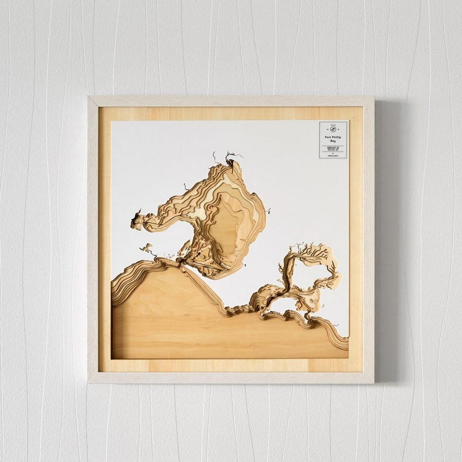
THIS 3D WOODEN CONTOUR MAP SHOWS VICTORIA’S PORT PHILLIP BAY IN STUNNING DETAIL. THE COASTLINE INCLUDES MELBOURNE AND 16 BAYS IN TOTAL. HOME TO PHILLIP ISLAND, THIS SALTWATER PLAYGROUND IS LOVED BY SURFERS, SAILORS AND MANY OTHERS. THE WATER IS SURPRISING SHALLOW IN MANY PLACES WITH THE AVERAGE DEPTH BEING 8M.
Pangea Maps was born out of a love for the water. The vastness and beauty below the water’s surface is what we wanted to capture. Using bathymetric data our 3D maps depict the contours of the ocean floor and reveal those treasured spots where we can surf, dive, swim, sail and play.
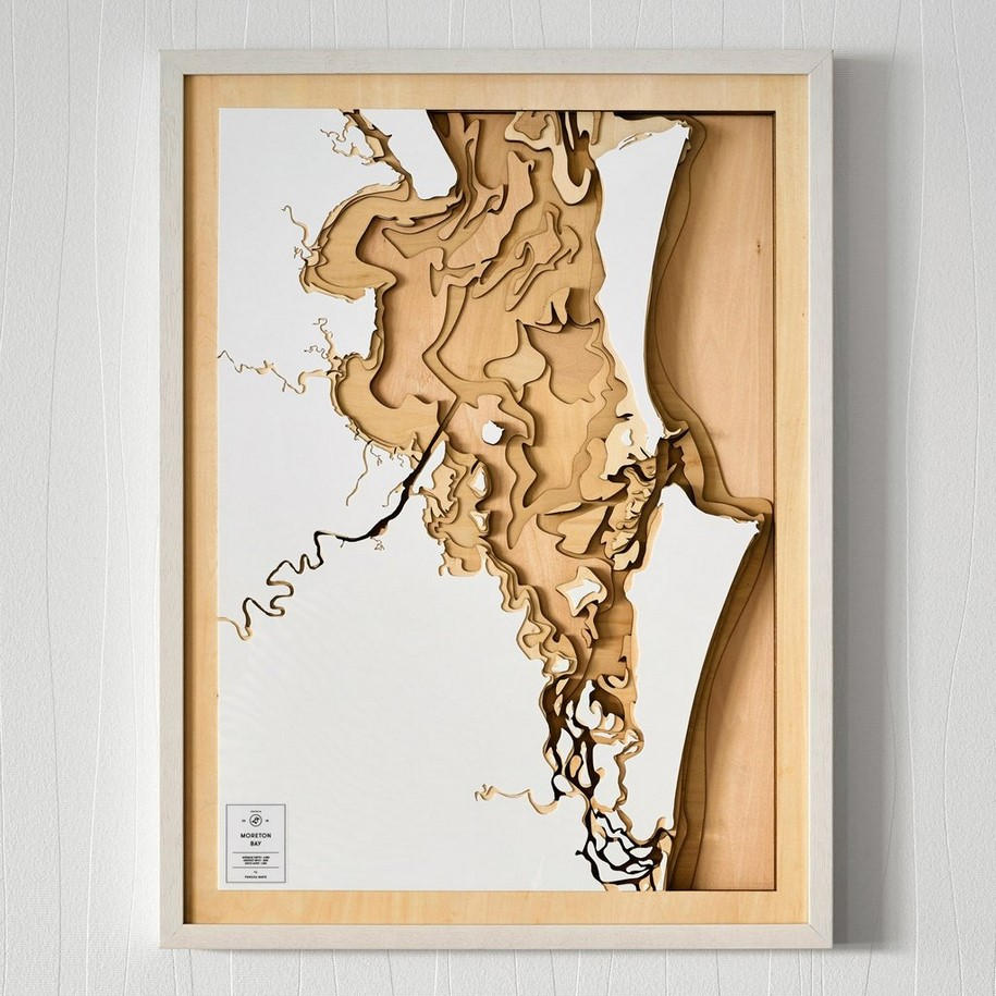
A STUNNING 3D WOODEN CONTOUR MAP OF THE MORETON BAY REGION. IT CAPTURES BRISBANE AND THE MANY ISLANDS THAT MAKE UP THE BAY (MORETON, STRADBROKE AND BRIBIE TO NAME A FEW!). FOLLOW THE CONTOURS OF THE OCEAN FLOOR AND RIVER INLETS. LET YOUR IMAGINATION RUN WILD AS YOU PICTURE THE DEEP BLUE AND TURQUOISE WATERS FLOWING THROUGH THE CHANNELS.
Process & materials of Pangea
The scale and composition of each map is carefully considered. Once a region has been identified the bathymetric data is sourced and the contours are sketched. This is a meticulous process combining modern surveying techniques and CAD technology with the art of cartography.
MASSACHUSETTS, KNOWN AS THE BAY STATE, HAS SOME OF THE MOST DISTINCTIVE COASTLINE IN THE WORLD. BOSTON HARBOUR IS SCATTERED WITH SEVERAL ISLANDS, SOME OF WHICH PROVIDE SHELTER FROM THE OPEN ATLANTIC OCEAN. FURTHER SOUTH OF BOSTON, CAPE COD MEETS THE ATLANTIC OCEAN AND CURLS AROUND TO FORM ANOTHER LARGE BAY WHICH IS PROTECTED. LOCALS OF THE BAY STATE ENJOY THE BEACHES, BOATING, FISHING AND MUCH MORE – ALL ON OFFER IN THIS BEAUTIFUL PART OF THE WORLD.
The contoured layers are then laser-cut out of plywood sheets. The natural grain of the sustainably sourced wood provides unique features to every piece. Each layer represents between 1-5m of water depth (depending on the region). To form the 3D map the layers are methodically hand-glued together and this is the most time-consuming step which can take 5 hours per map.
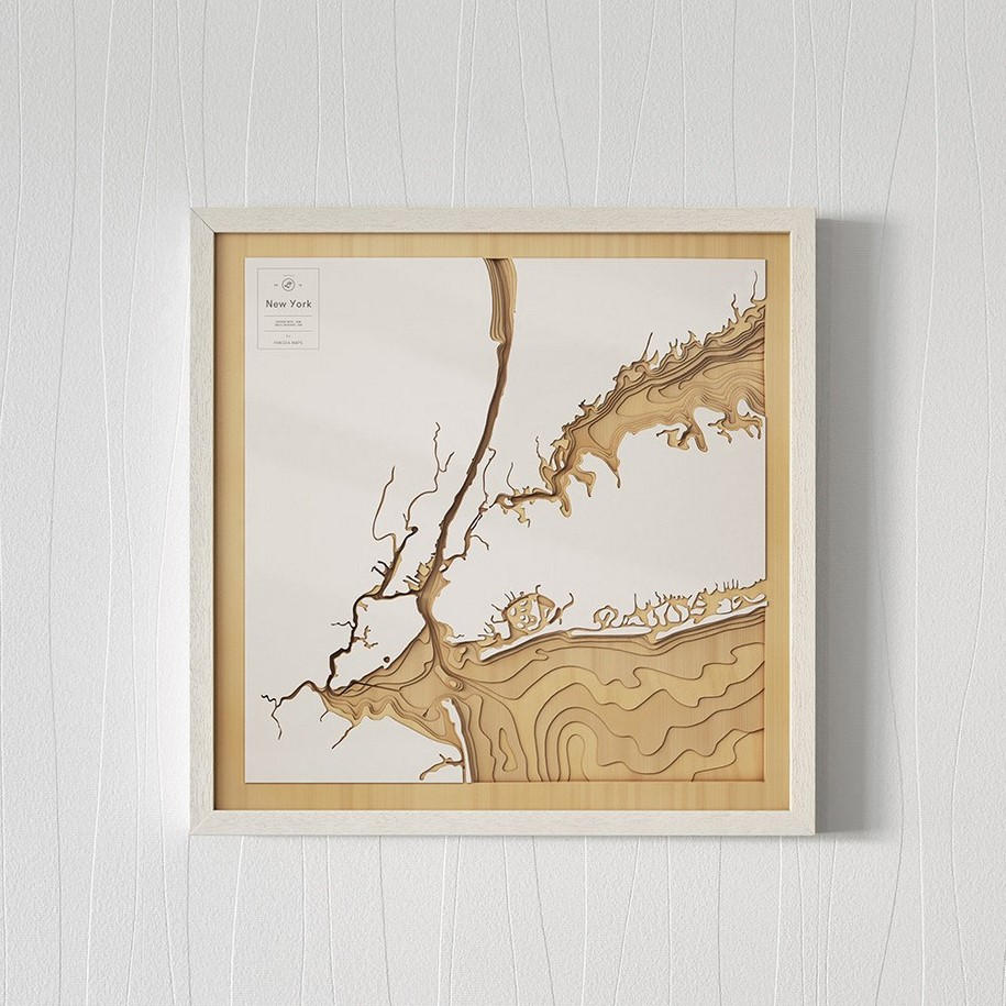
AMERICA’S MOST ICONIC CITY, NEW YORK, IS MADE-UP OF 5 BOROUGHS THAT ARE SURROUNDED BY BEAUTIFUL WATERWAYS. NEW YORK BAY IS THE CENTREPIECE WHERE THE HUDSON RIVER MEETS THE ATLANTIC OCEAN.
Laser cut white acrylic forms the top layer, representing the land, with the intention to keep things simple and focus the eye on the ocean and its intricacies.
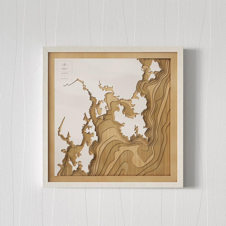
AUSTRALIA’S ISLAND STATE, TASMANIA, HAS SOME OF THE MOST BEAUTIFUL UNTOUCHED COASTLINES IN THE WORLD. THE CAPITAL HOBART BOASTS A BEAUTIFUL PORT THAT SEES THE FINISHING OF THE ANNUAL SYDNEY TO HOBART YACHT RACE AND IS HOME TO ICONIC HARBOUR SIDE AREAS INCLUDING SALAMANCA PLACE, BATTERY POINT, VICTORIA DOCK AND CONSTITUTION DOCK. JUST BEYOND THE PORT, THE DERWENT RIVER FLOWS INTO THE TASMAN SEA, WHERE THE WATER SURROUNDS THE STUNNING BRUNY ISLAND AND PORT ARTHUR.
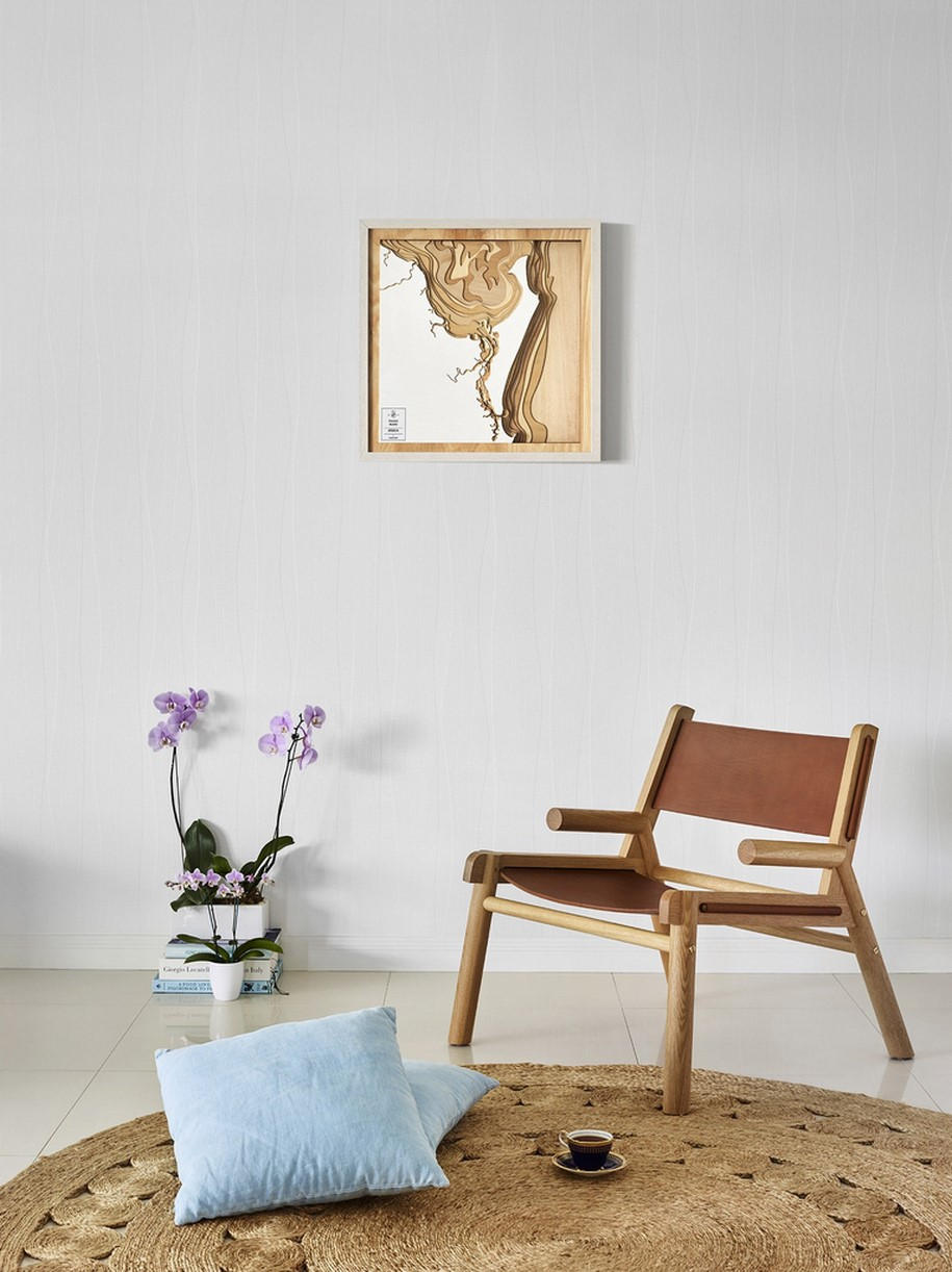
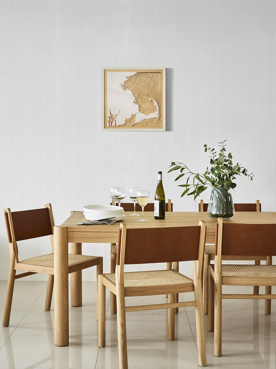
A natural hardwood white frame with protective plexiglass finishes the map and it is ready to hang. We post each map in a beautiful wooden box making it the perfect gift.