The article features 4 design theses on walkable architecture: student works that explore the relations between movement, matter and memory by focusing on the architectures we create as we walk and the ones created to be walked.
thesis ‘path(-ώ): remntants of (k)nots’, [μονοπατώ: εμπλοκές σε ενθύμια ορίων]
We exist in an imperfect world, shaped by the ruins of past futures.
Wandering through geographical chaos, we leave behind traces—disordered yet forming polymorphous landscapes. As in Bruce Chatwin’s Songlines, where paths become carriers of memory and myth, every step here is both journey and story.
The past, not the future, is the true field of contingency; every movement circles back to sacred sites, geological rhapsodies, and the songs we create as we walk.
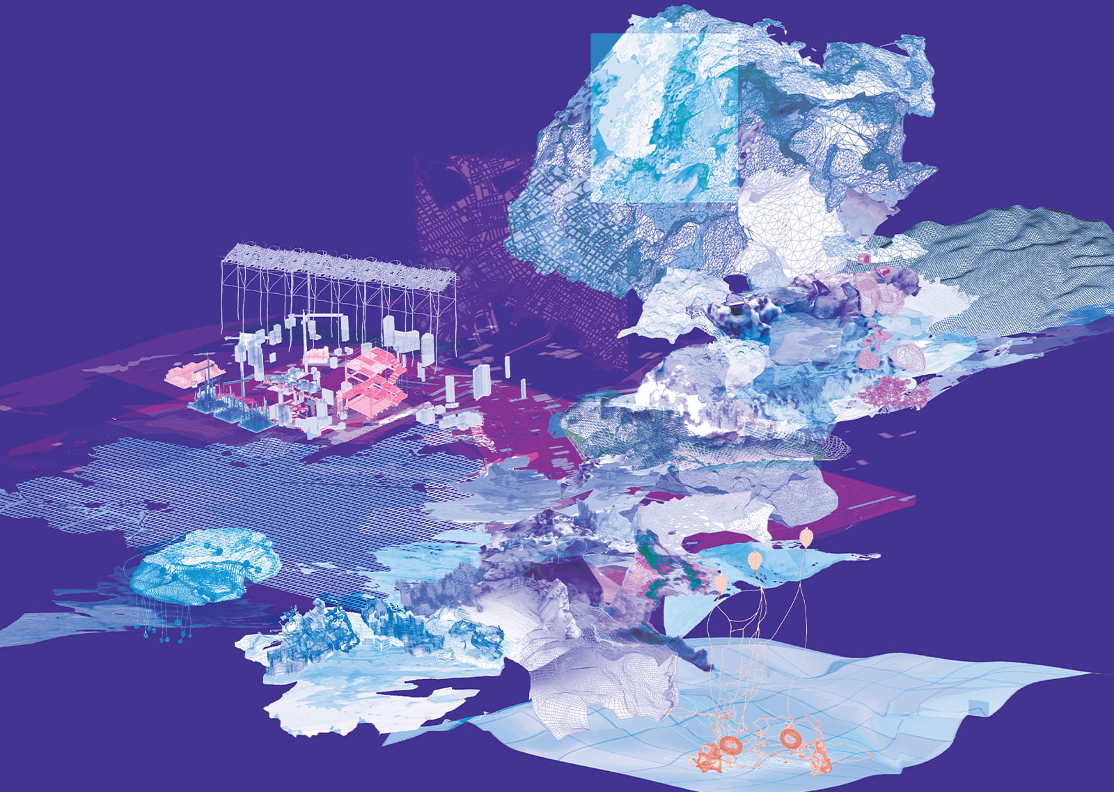
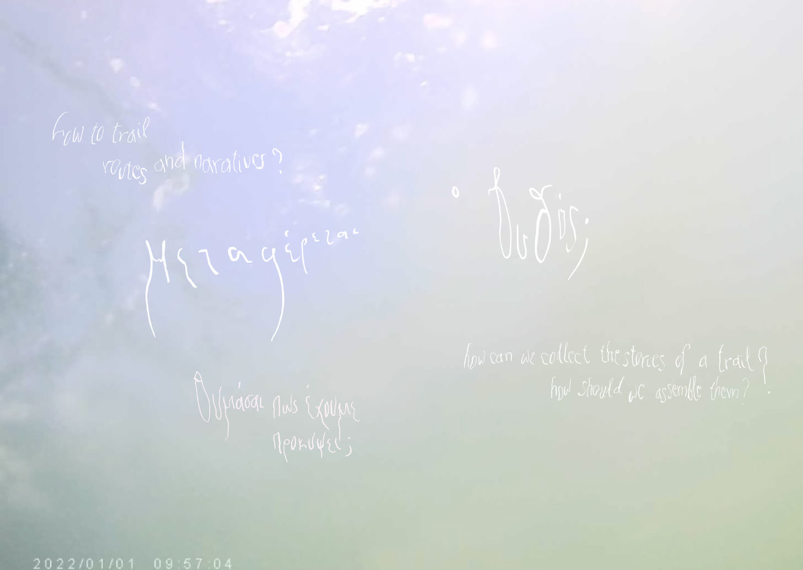
Movement becomes ritual —an exploration of hybrid, symbiotic, shifting states. Through a synthetic investigation, we trace landscapes, paths, and ecosystems over time, engaging with materials, recycling structures, and reshaping realities.
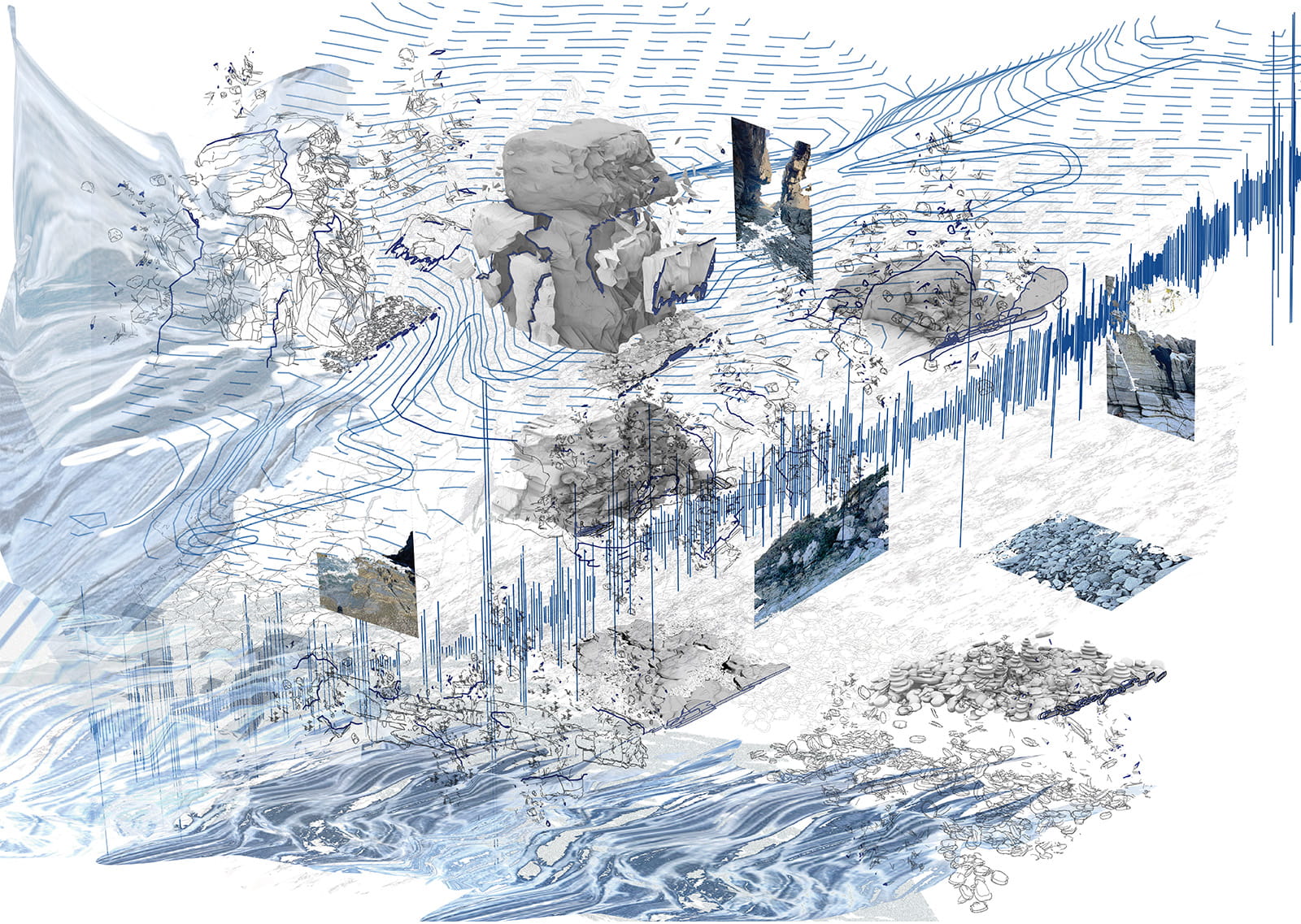
Through the parameters of time, biology, and evolution, this work unfolds as a traveling chronicle—a study of transformation, where organic variables emerge, materials are recycled, and physical structures evolve.
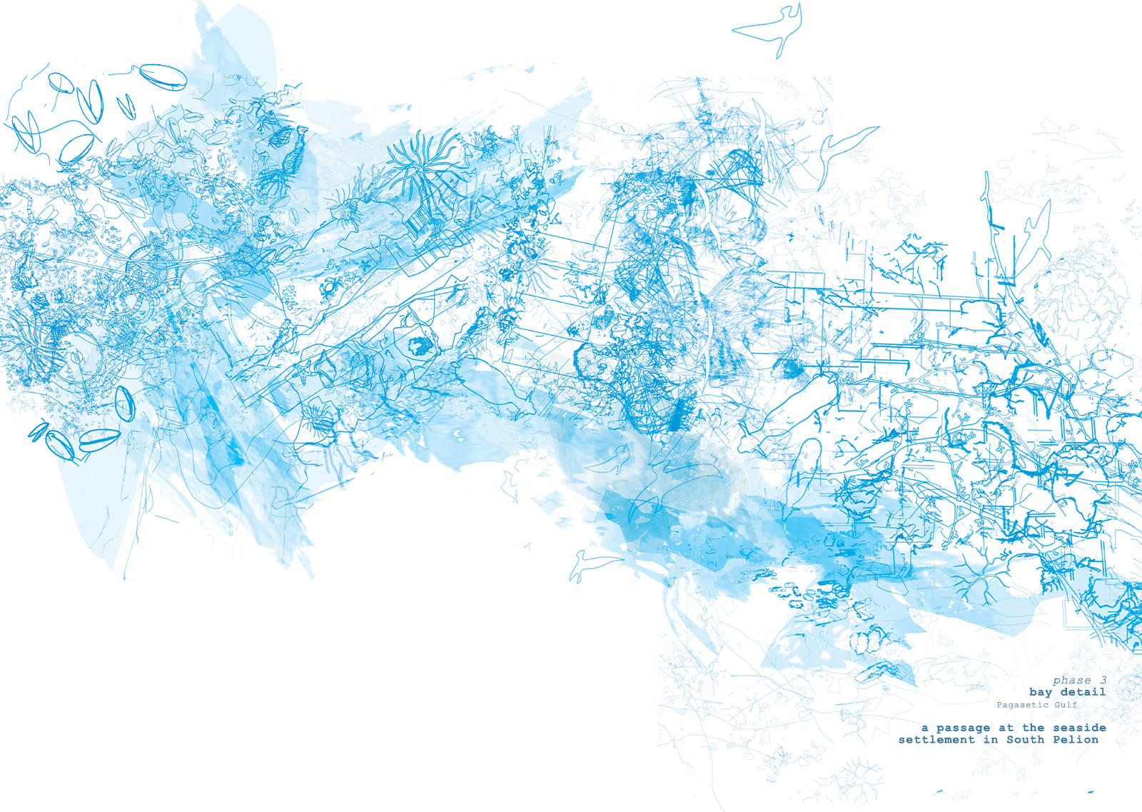
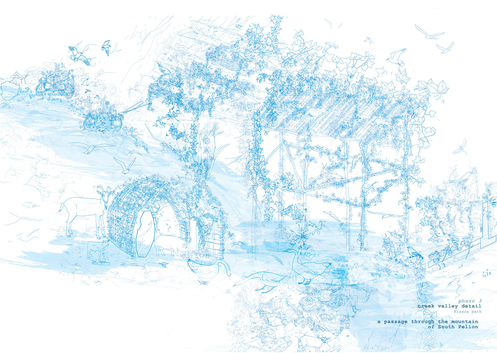
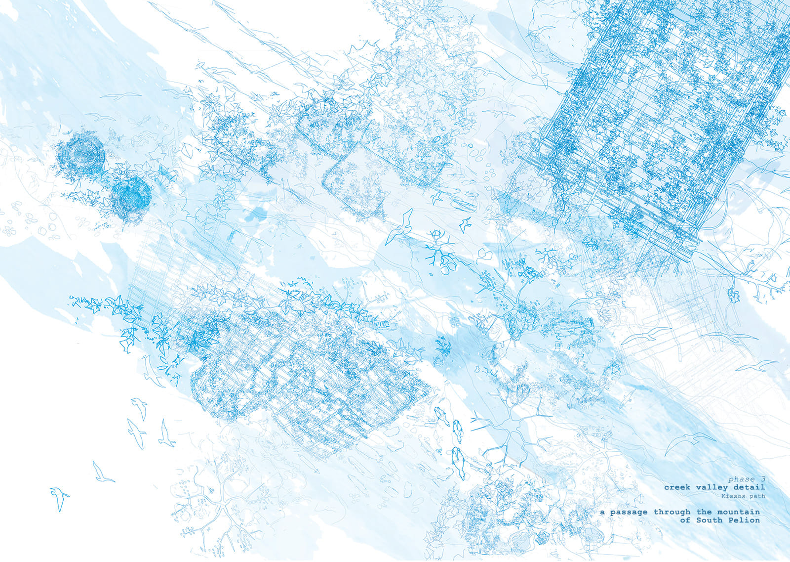
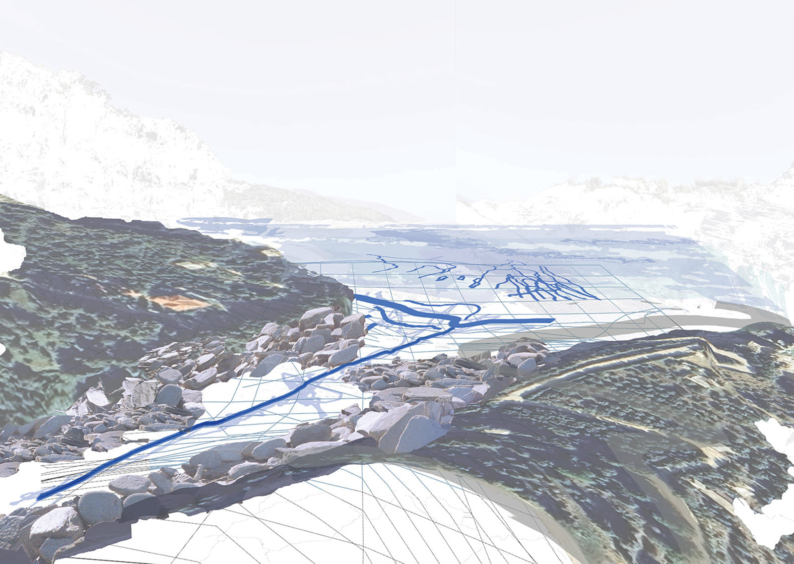
The practice of walking and engaging with place becomes a field of investigation: recording, locating, wandering, and networking within material space.
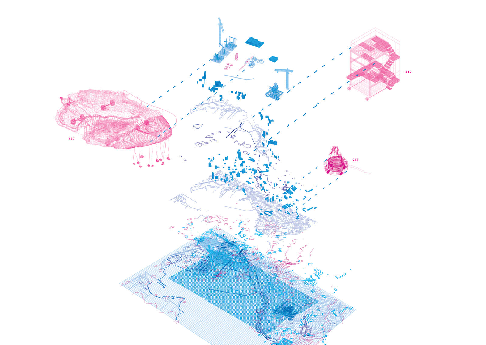
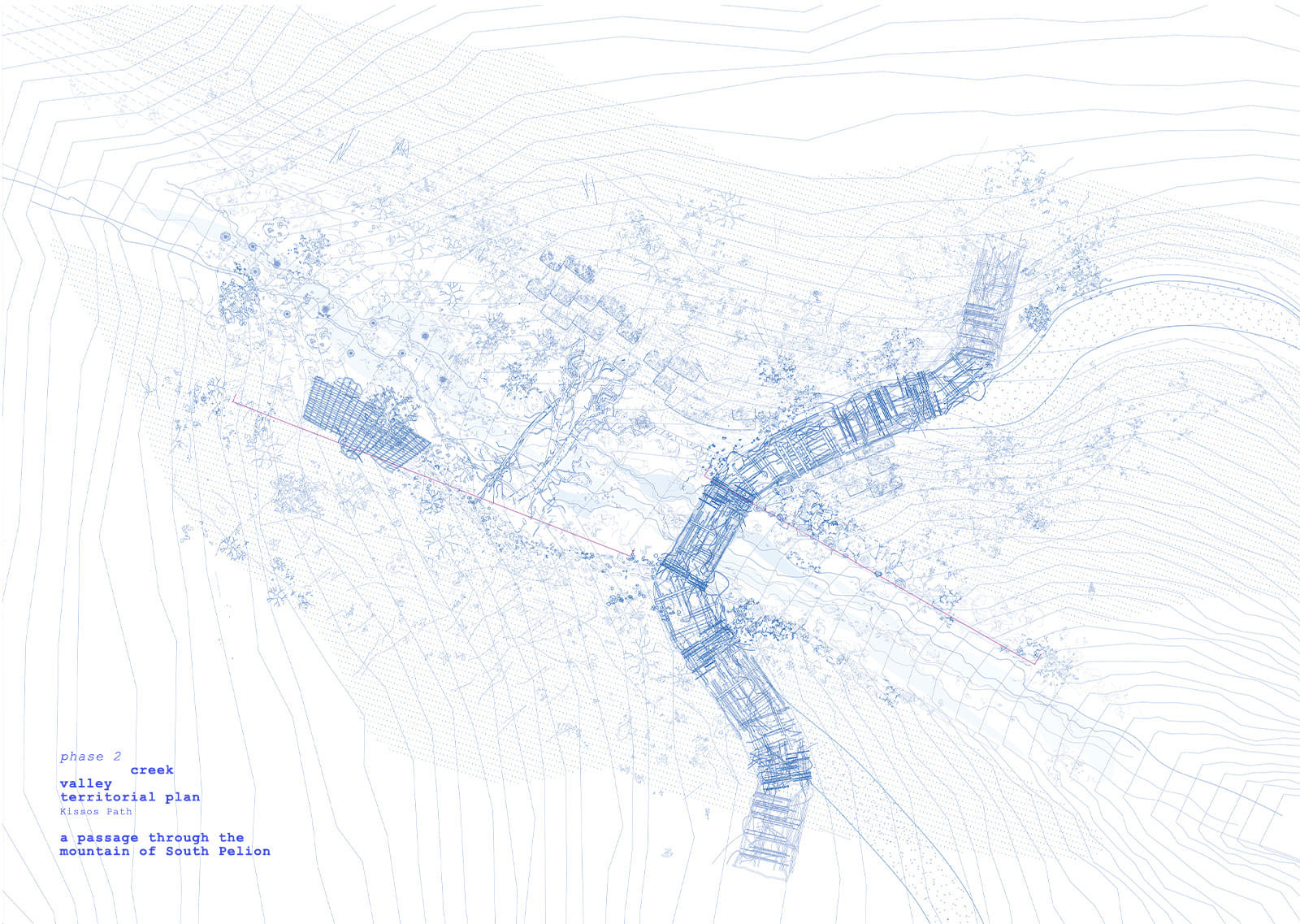
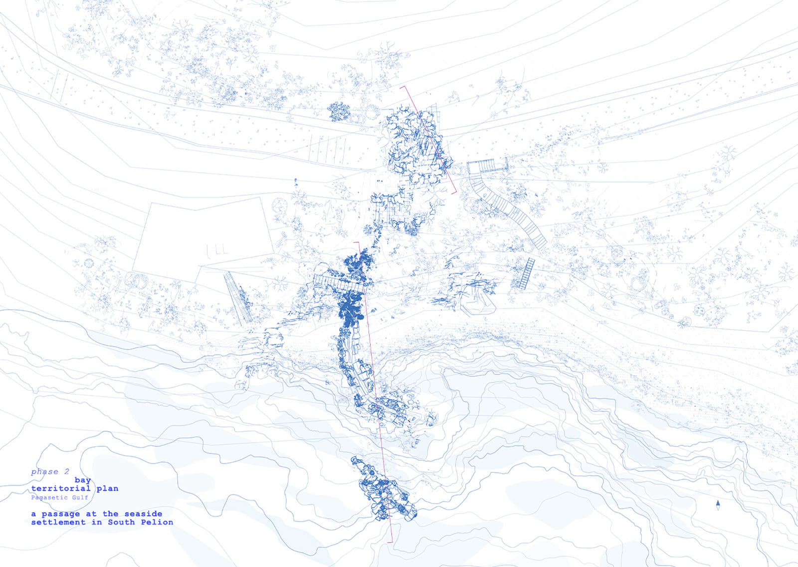
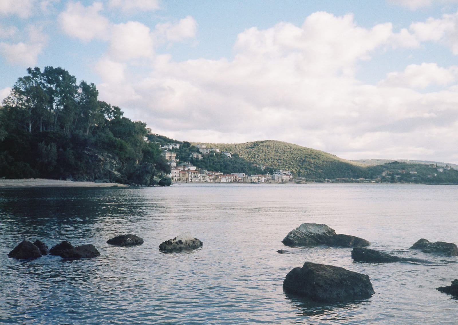
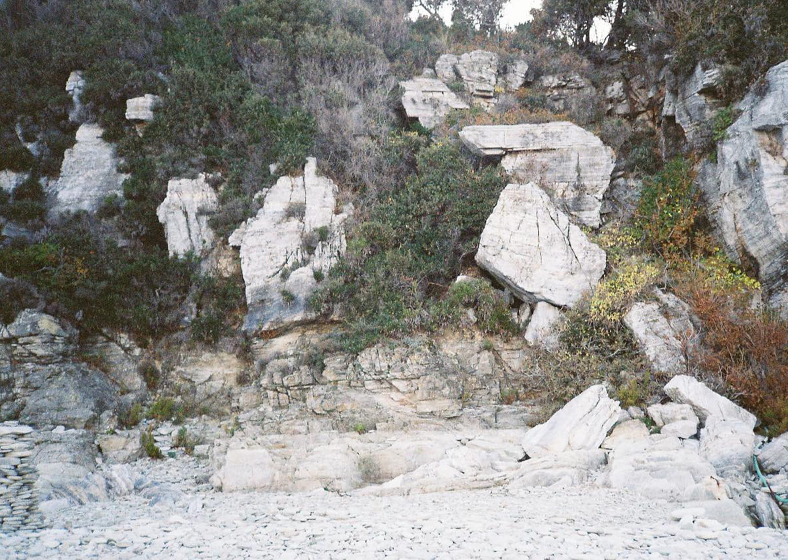
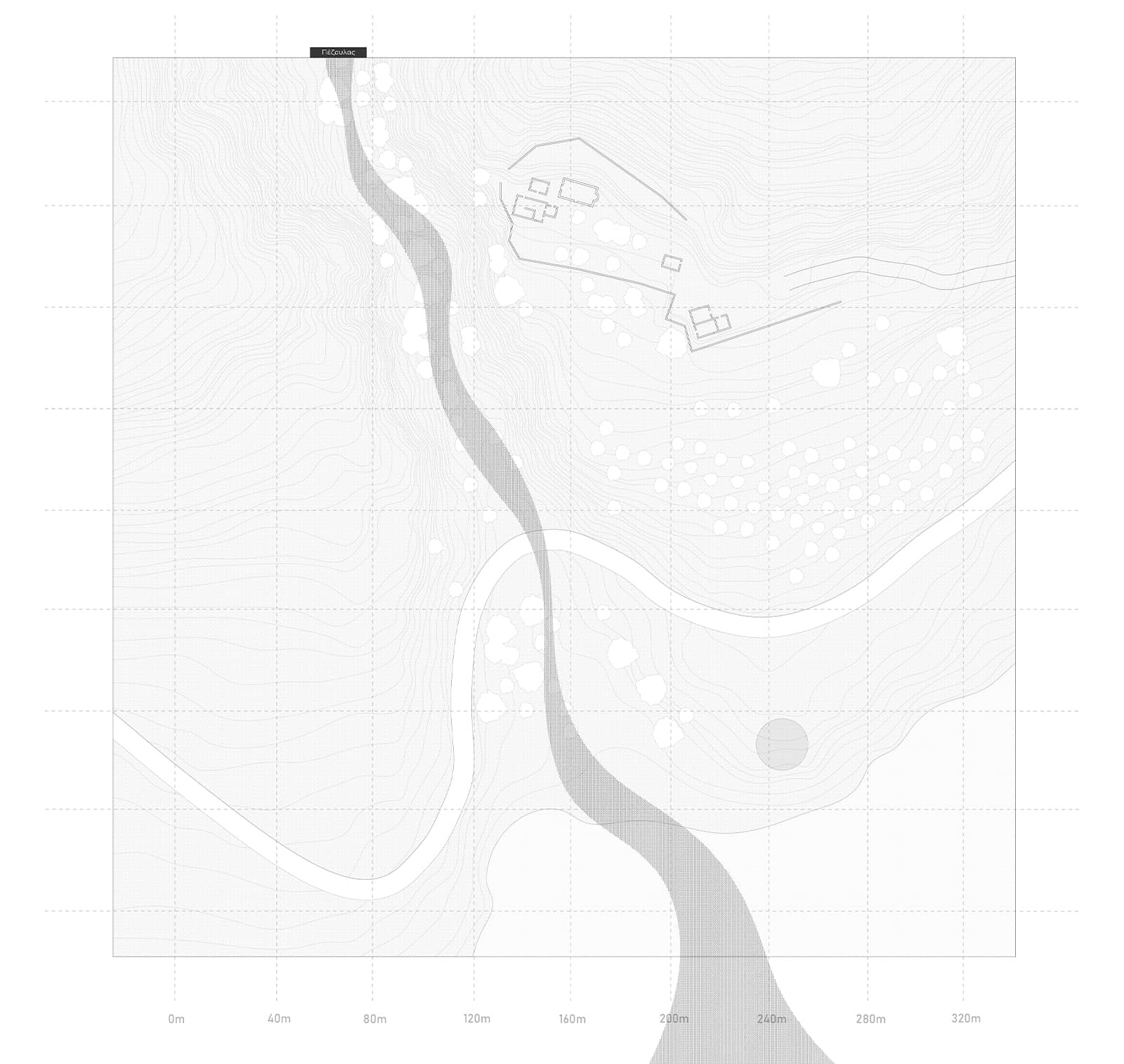
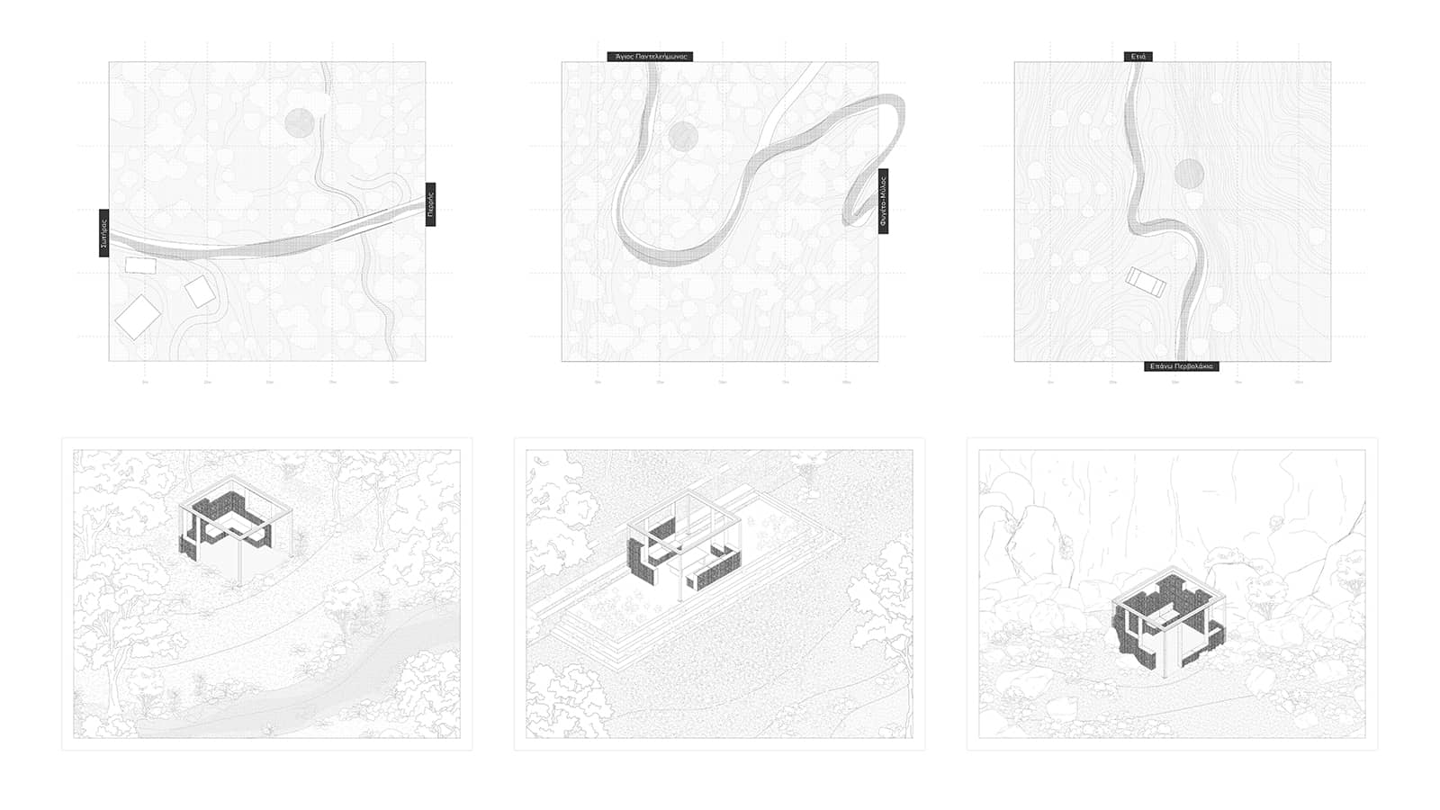
The research follows four intra-coastal trails at Pelion along the Pagasitikos and Aegean coastlines—Nireas, the winter swimmers’ beach; the Volos plates; Lagoudi near Afissos; Kalamaki / Propan beach; and the waterfalls of Kissos.
These sites form a dynamic field of exploration, converging at Lagoudi and Kissos, where applied studies imprint the evolution of organic variables and the interaction between human and non-human agents.
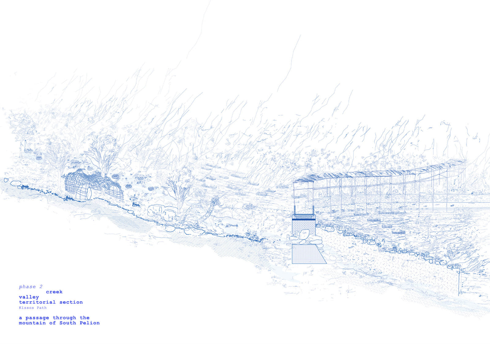
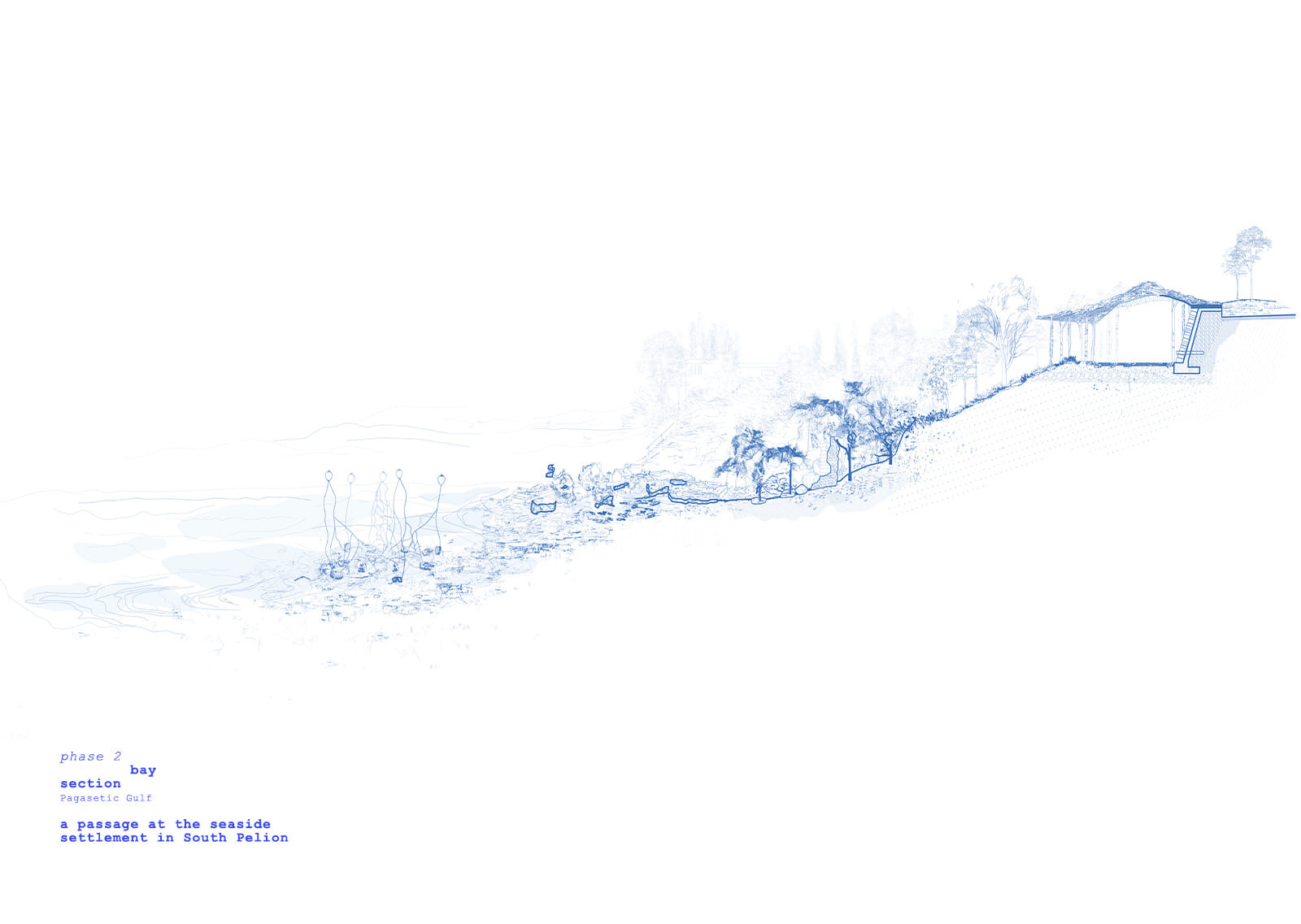
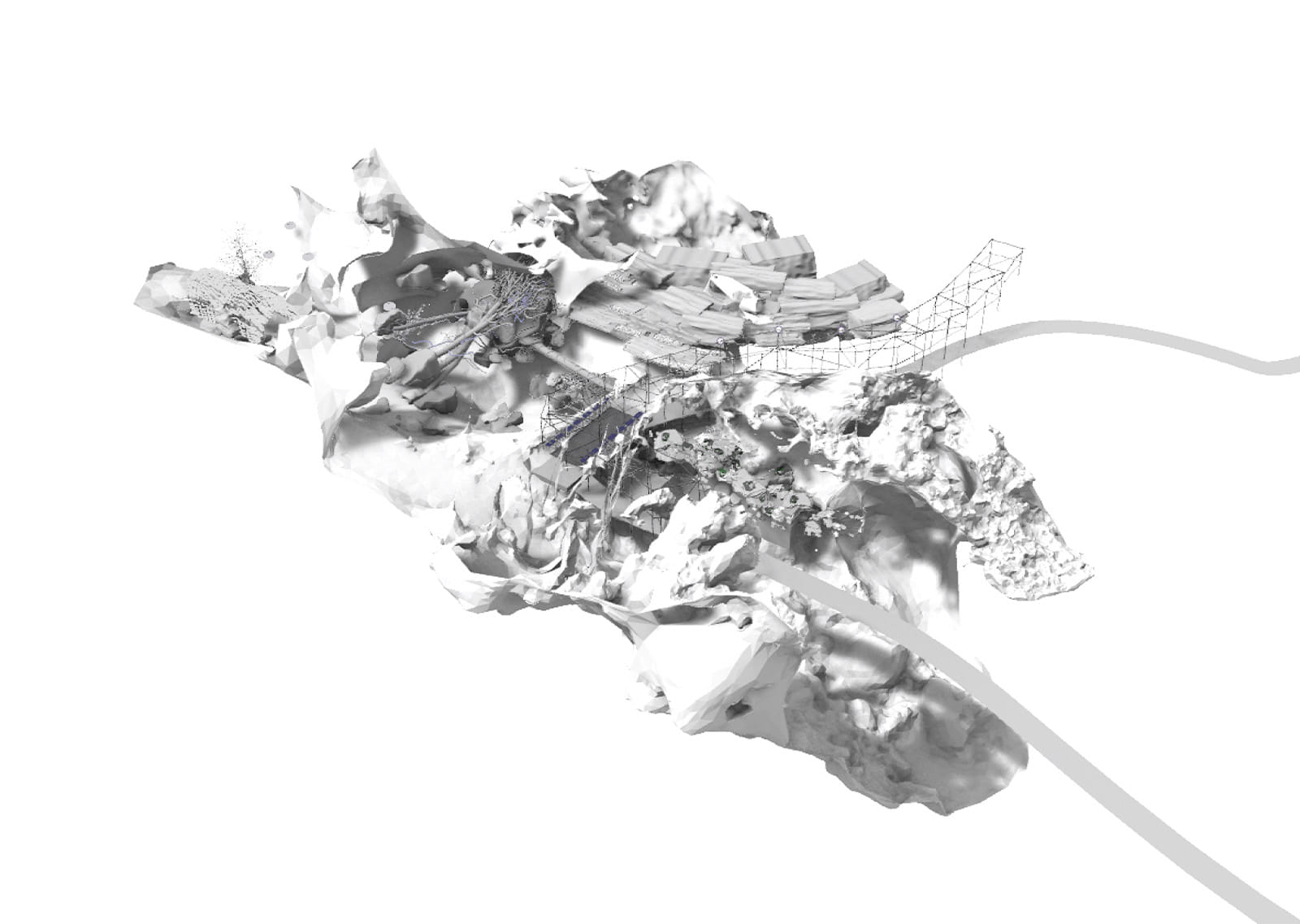
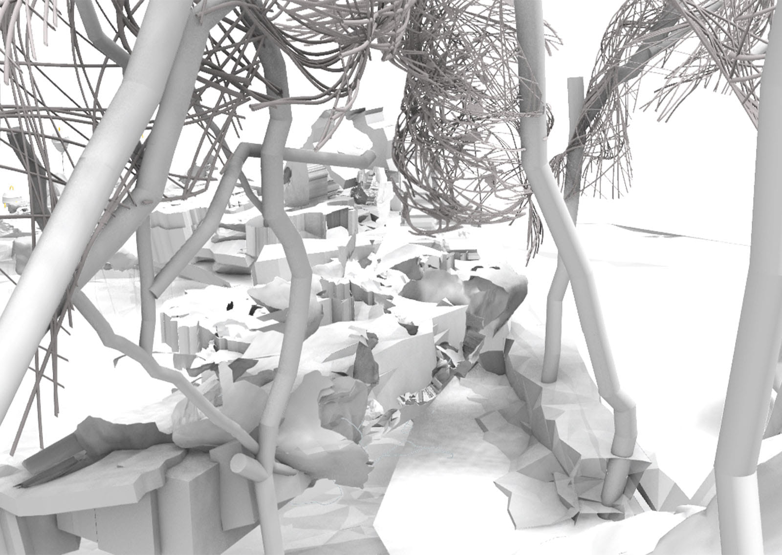
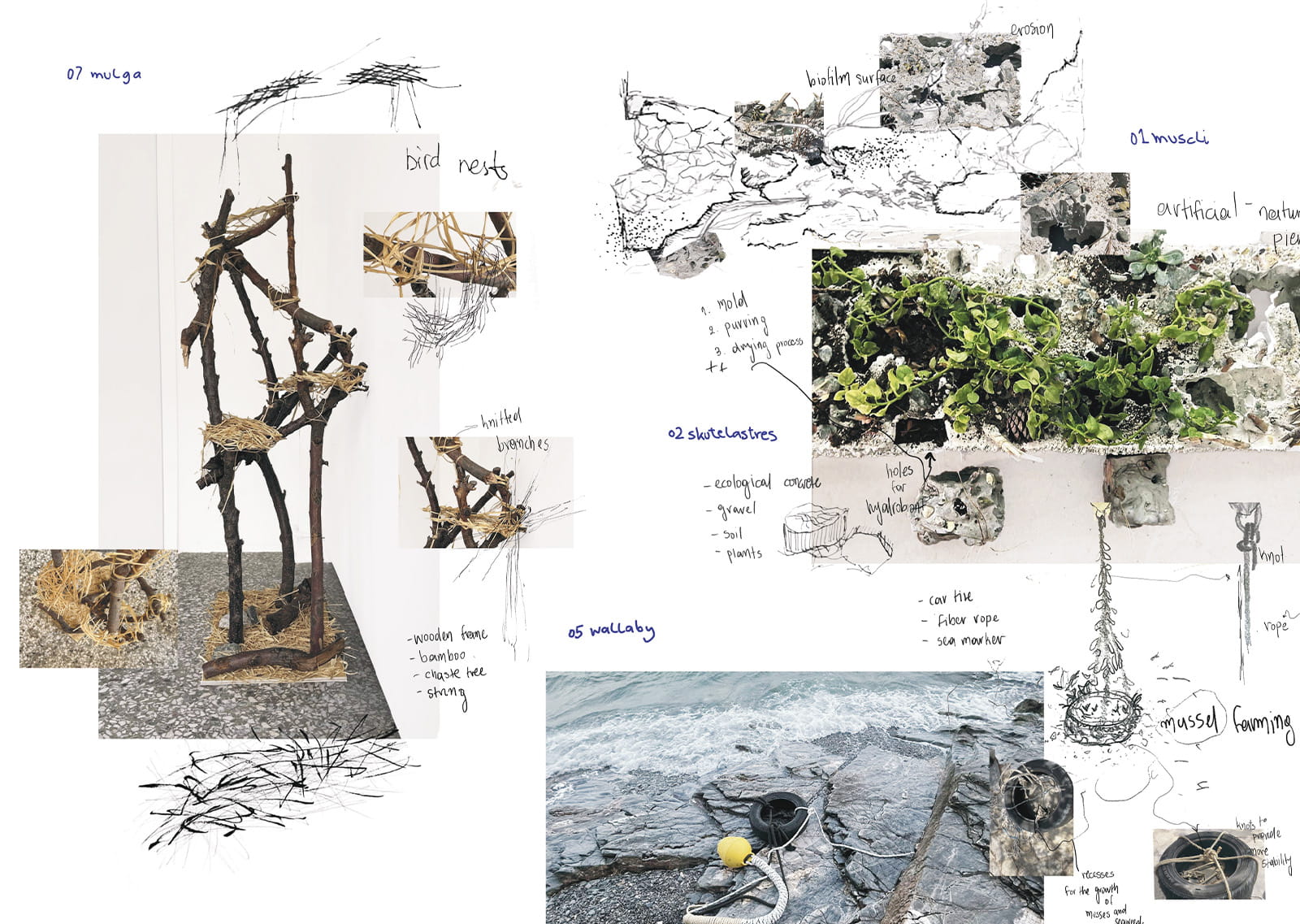
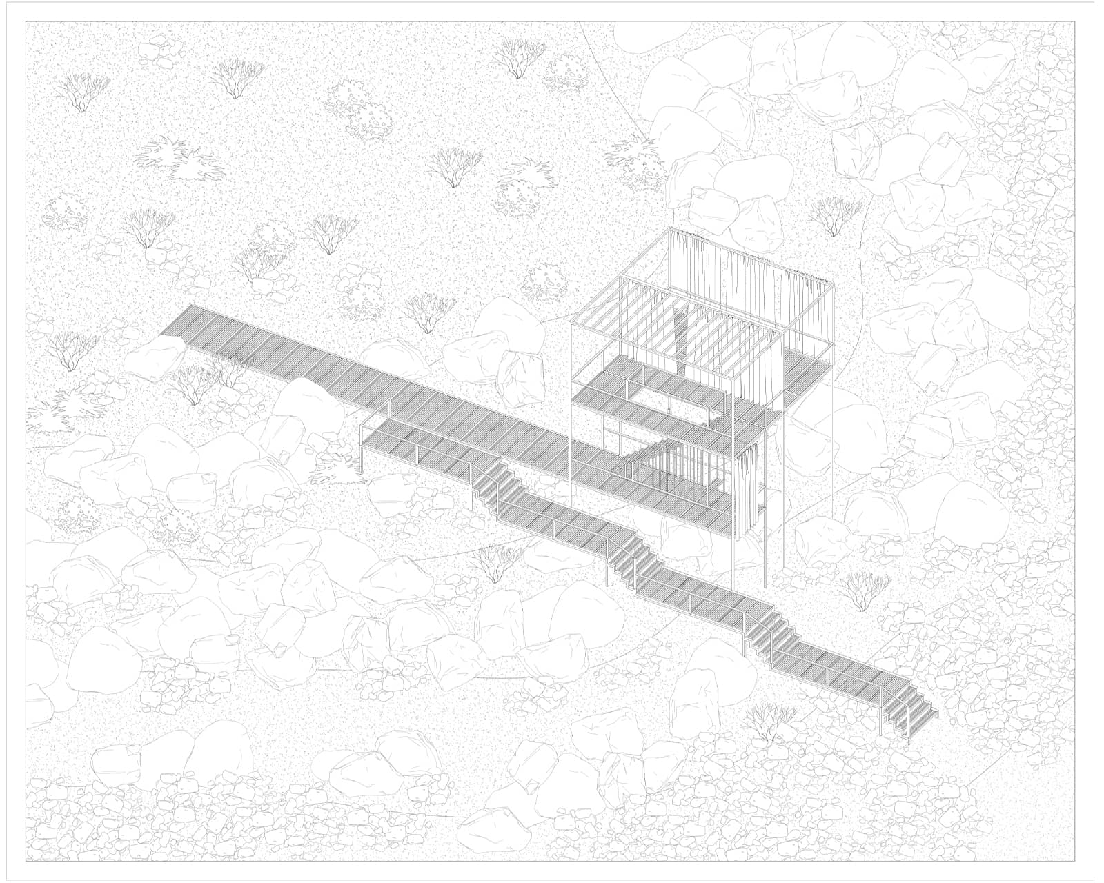
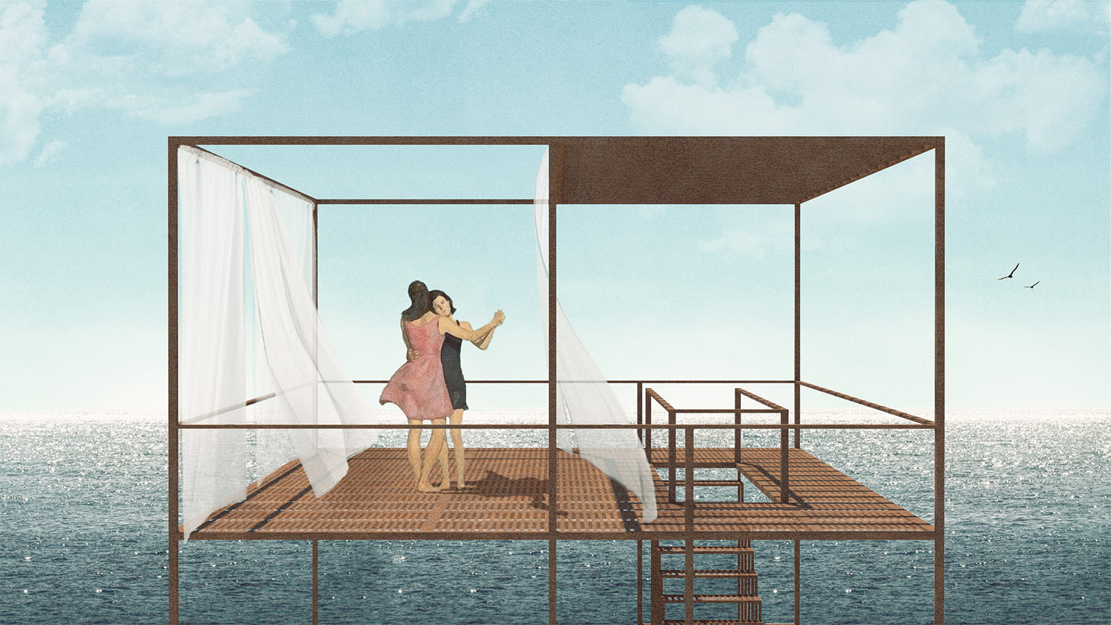
Ten prototypes emerge—adaptive structures co-inhabited by organisms and micro-organisms, woven with local materials and artisanal knowledge.
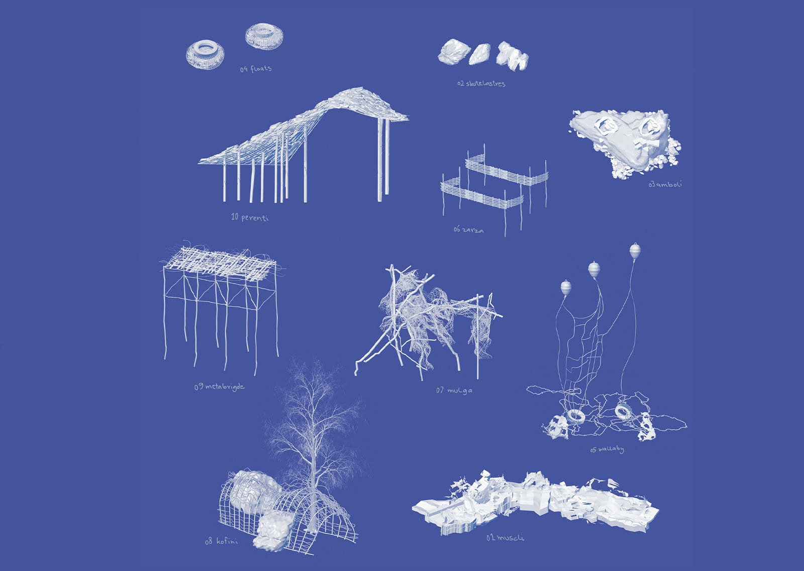
Wood and willow create shelters for birds and plants; clay, soil, and reeds stabilize slopes; stone, rope, and recycled materials form underwater assemblages for mussel farming and artificial reefs. Hybrid piers of timber, rock, and vegetation redefine the threshold between land and sea.
Between matter and movement, arises a question: what if the remnants of paths could emerge into parallel existence? A speculative yet grounded framework where traces, structures, and living systems unfold as parallel narratives of place.
So Welcome to Hypertopio—a composite of the paths we’ve walked and the prototypes we’ve designed. A spatial and ecological weave between the human, the non-human, the geologic, and the speculative.
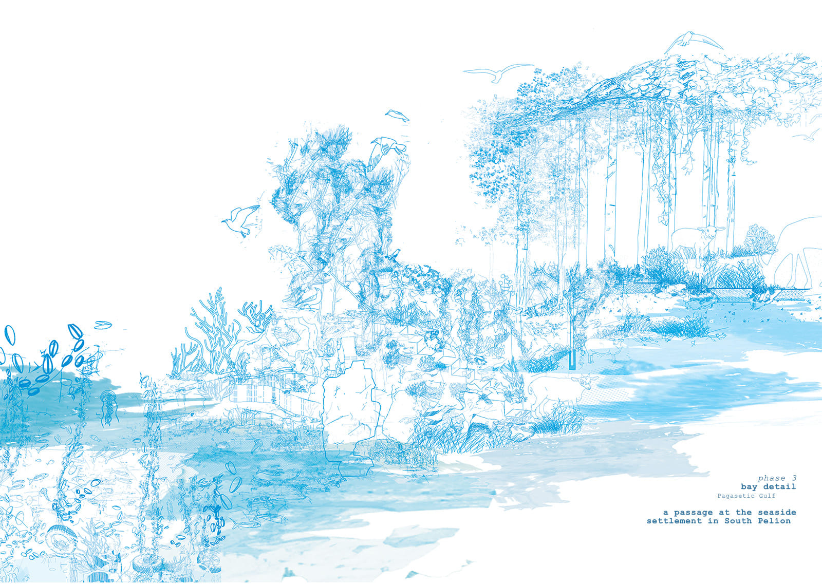
A living archive of possible futures—ritual, network, and symbiosis in constant transformation. A layered terrain where memory, movement, and material converge into a system of non-human imaginary magical realism.
We propose Hypertopio, as a method of thinking, building, and being in the world—where design is not an imposition but a form of listening; where place is not fixed, but continually rewritten through movement, entanglement, and shared responsibility.
Nothing dies entirely; each meaning awaits its rebirth.
Video Credits: Giannis Dolias (quarrier), Vasoula Dolia (geologist), Christos Katsis (weaver), Mr.Stefanos (weaver)
Drone plans curated by Aerospection
Underwater plans curated by Volos: Deep Blue Academy
Mihalis Fountoulis, biologist
Department of Biology, National and Kapodistrian University of Athens
Facts & Credits
Project title thesis ‘path(-ώ): remntants of (k)nots’, [μονοπατώ: εμπλοκές σε ενθύμια ορίων]
Type Design Thesis
Students Aggeliki Papanikolaou, Aikaterini Tsevdou, Dimitra Papaspyrou (metaphyta collective team)
Supervisor Anthi Kosma, Phoebe Giannisi
Presentation Date February 2024
University School of Architecture, University of Thessaly
Text by the author
Towards a (re)appropriation: a hiking network in the abandoned villages of Eastern Lasithi
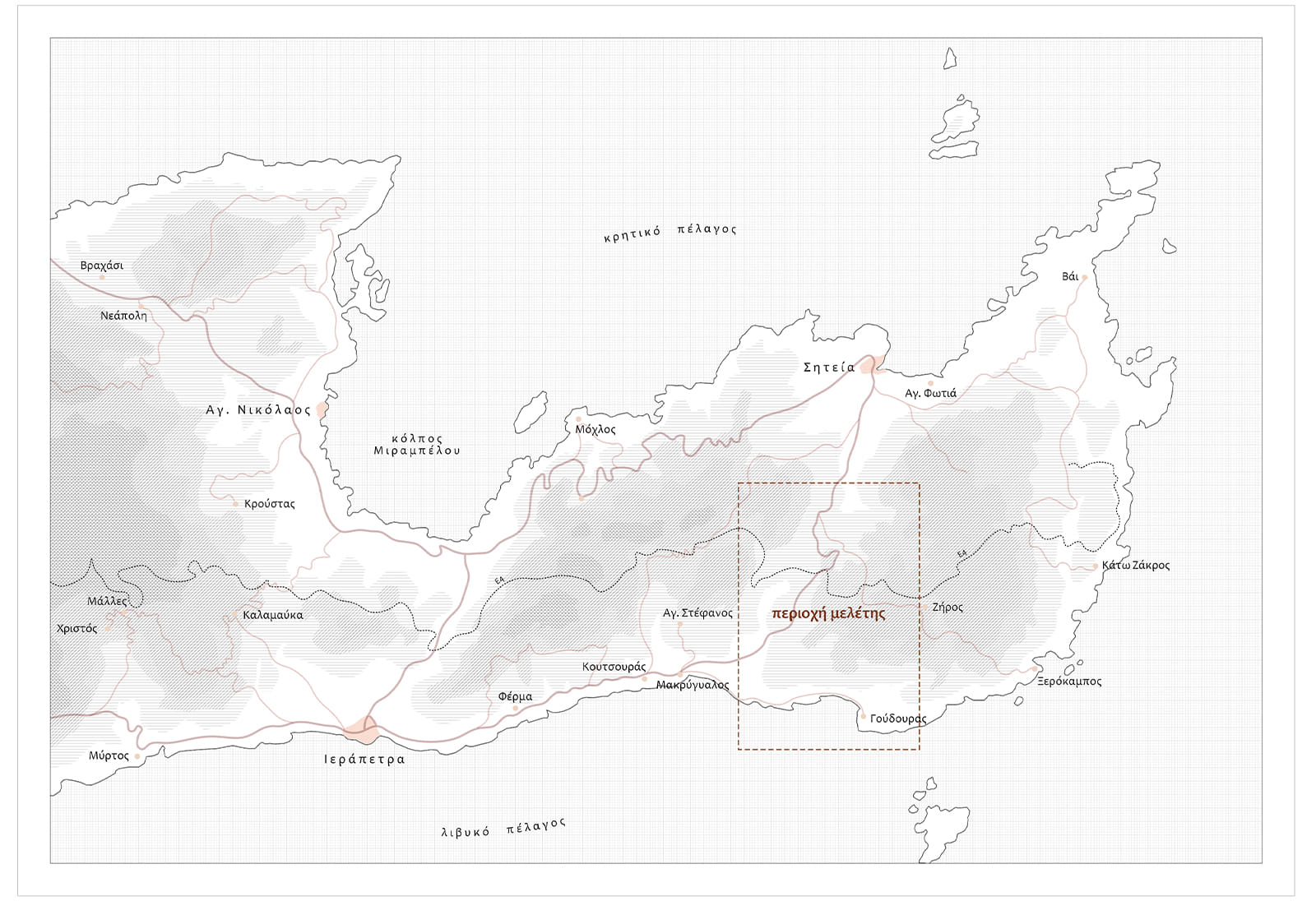
This thesis deals with the phenomenon of abandoned settlements in Eastern Lasithi, between the cities of Ierapetra and Sitia.
Its aim is to create a program that can lay the foundations for the re-inhabitation of selected settlements, proposing sustainable solutions that respond to contemporary concerns while recognizing the needs of the local community.
Through the creation of a hiking trail, the establishment of one or more seasonal communities, and an emphasis on continuous interaction between different users, the proposed program attempts to address the problem of rural abandonment as realistically as possible, offering alternative ways of living and coexisting to people who suffer from the fast pace of modern cities, without requiring a long-term commitment.
At the same time, it attempts to counteract similar approaches that either fail to bring about long-term solutions due to their detachment from the needs of modern man, or threaten to degrade the cultural and natural environment of the place.
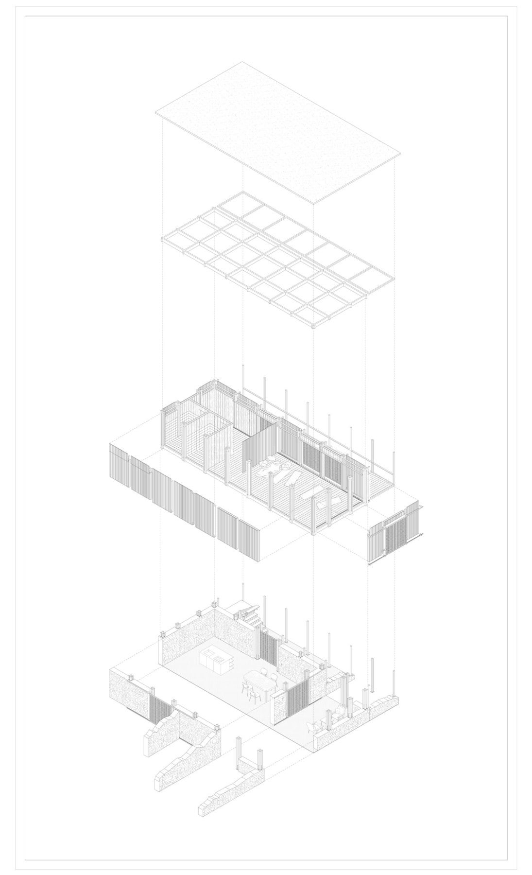
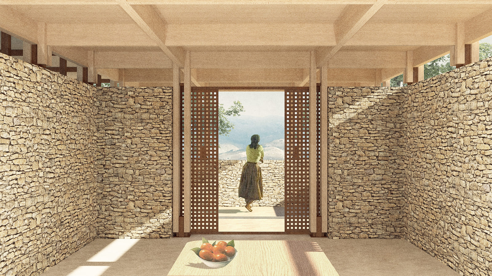
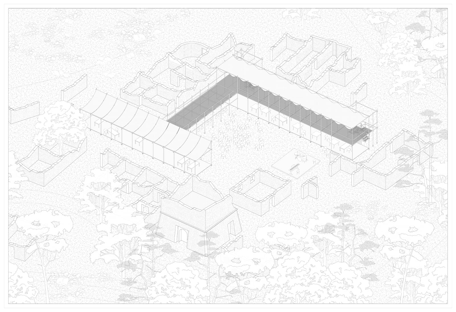
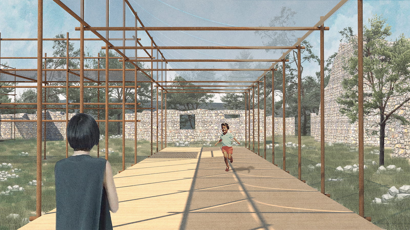
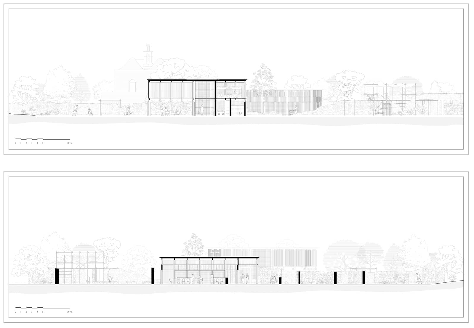
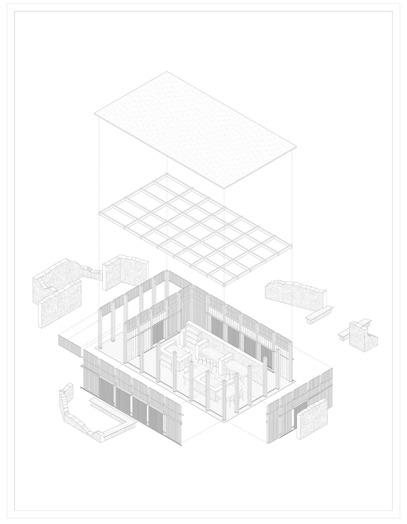
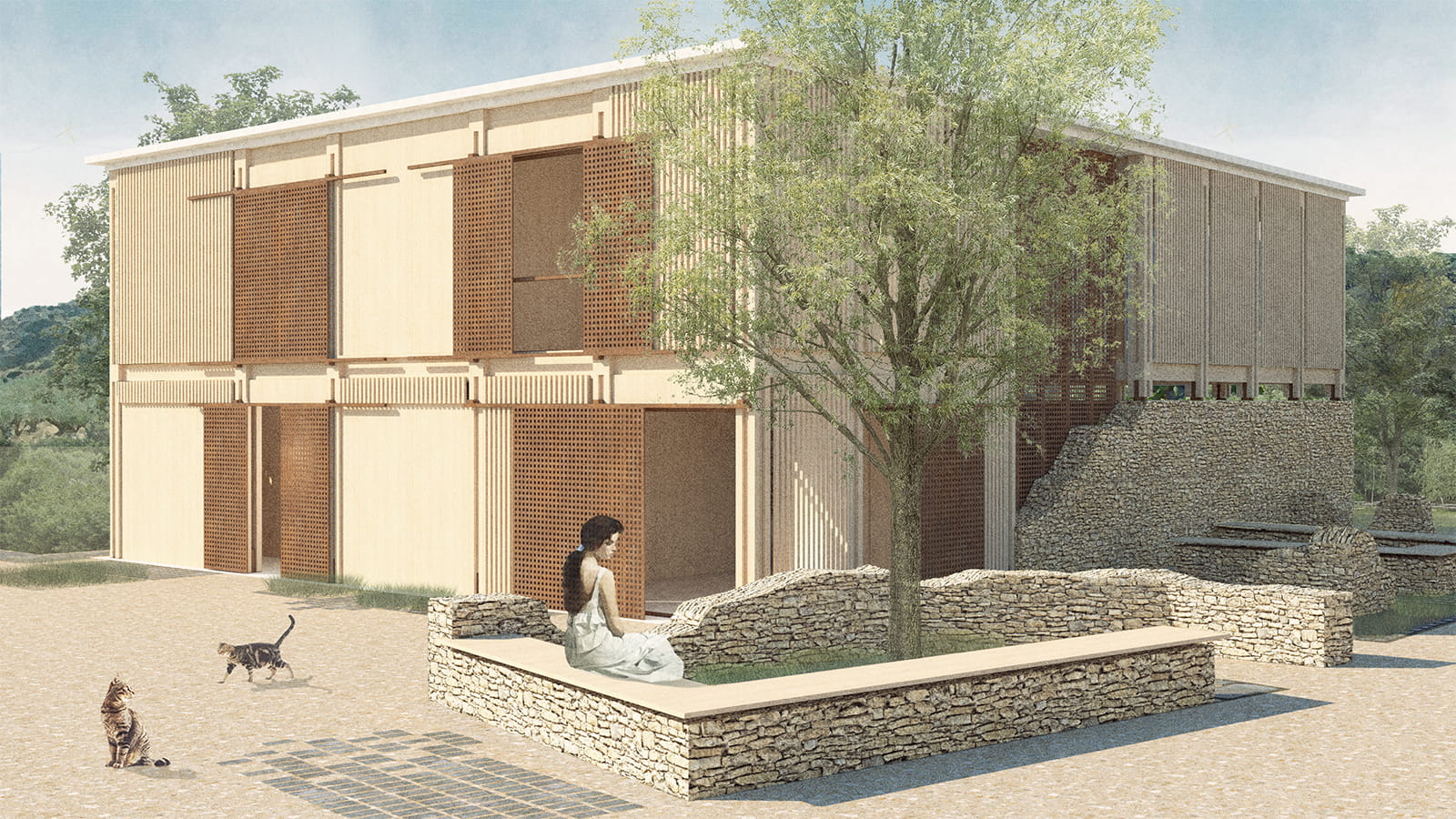
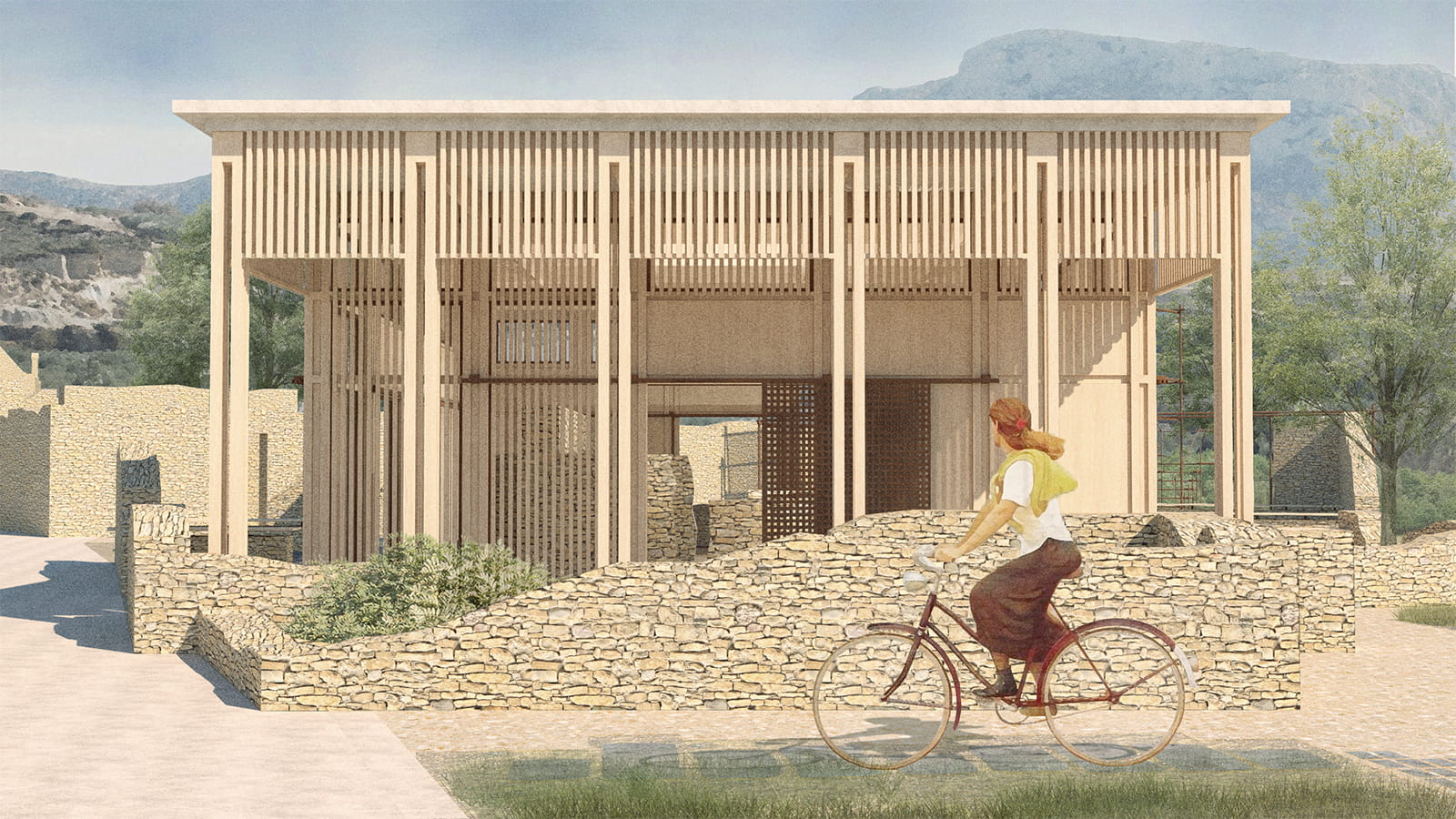
The proposed interventions are strategically located in abandoned settlements or other points of interest depending on their type, interacting in different ways with the existing natural or built landscape, always striving to harmonize, highlight, and converse, without ever overshadowing.
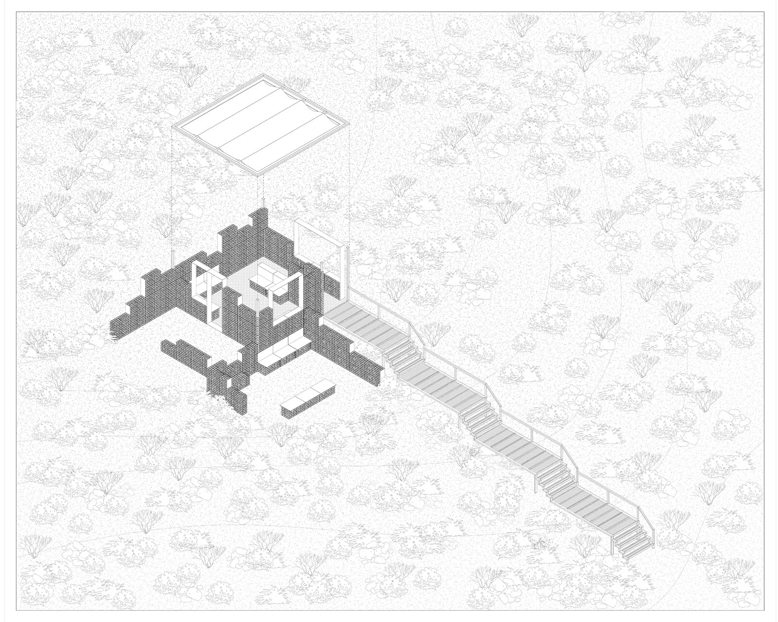
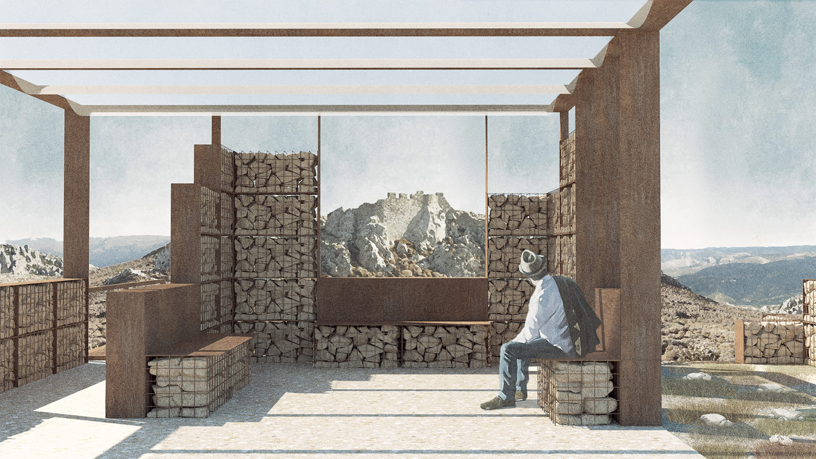
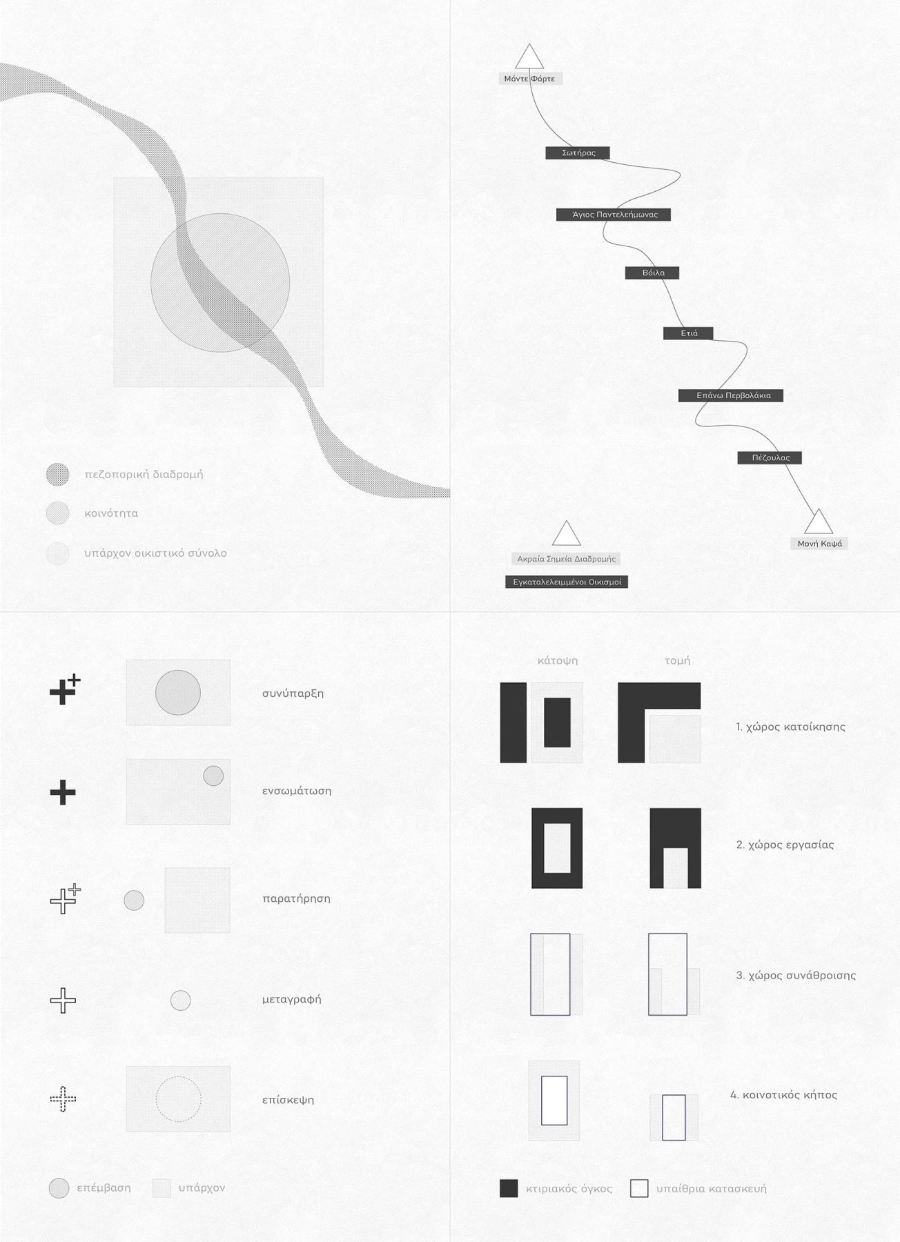
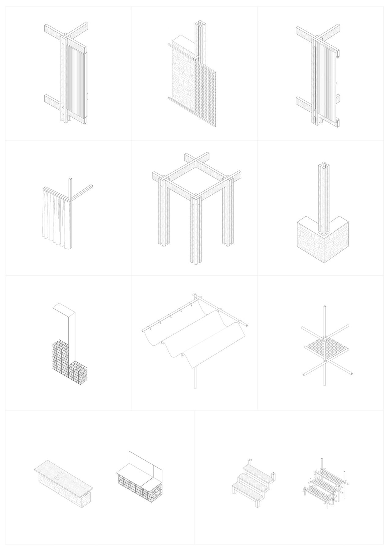
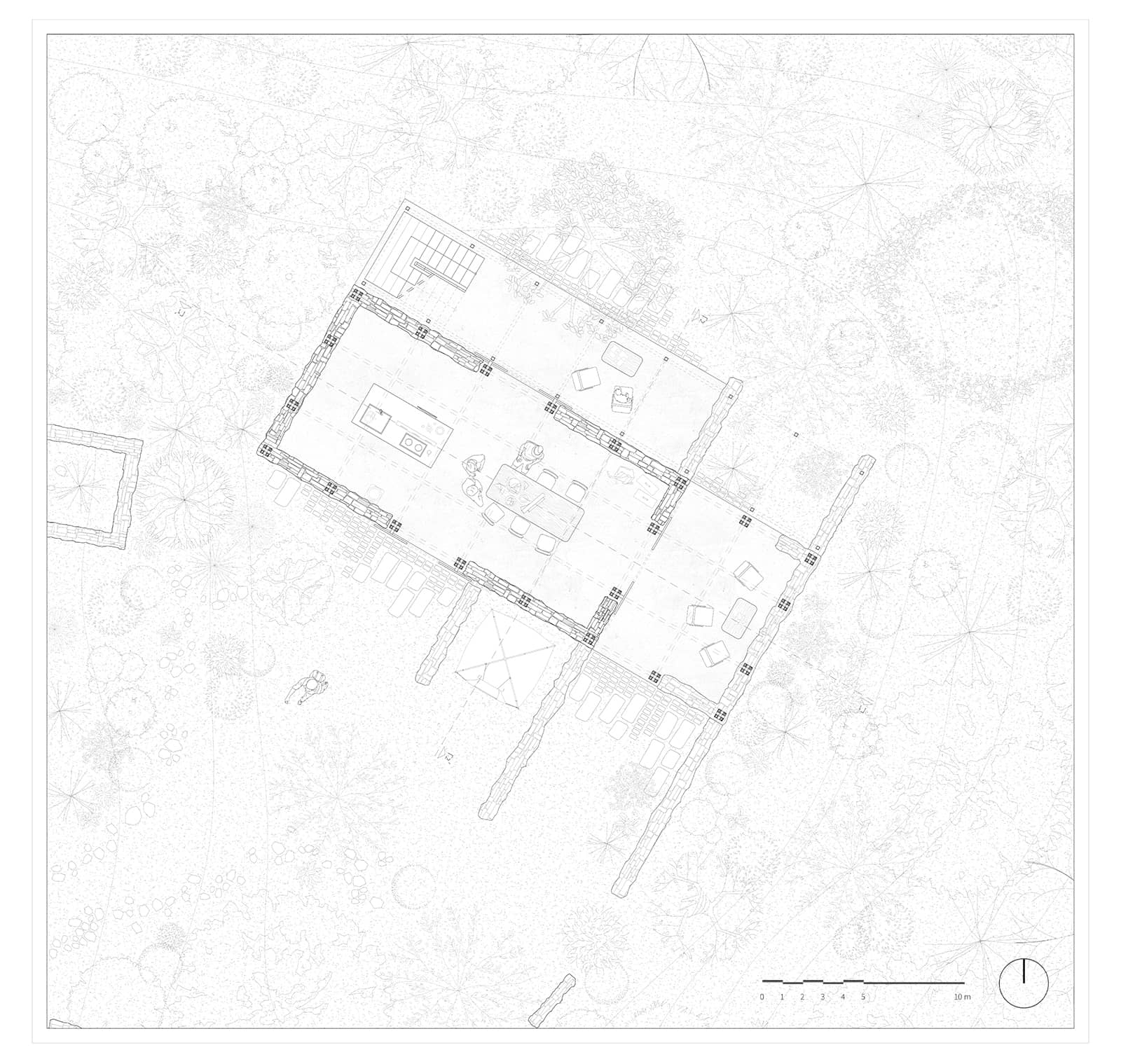
The types of interventions cover the different needs of our proposal and are divided into communities, shelters, observatories, stops, and event spaces, communicating with each other through common design languages, materials, and adaptations to the existing landscape.
The route that crosses the different intervention points activates each part of it, as well as existing active settlements in the area, transforming the proposal into a living organism that has the ability to evolve and develop continuously.
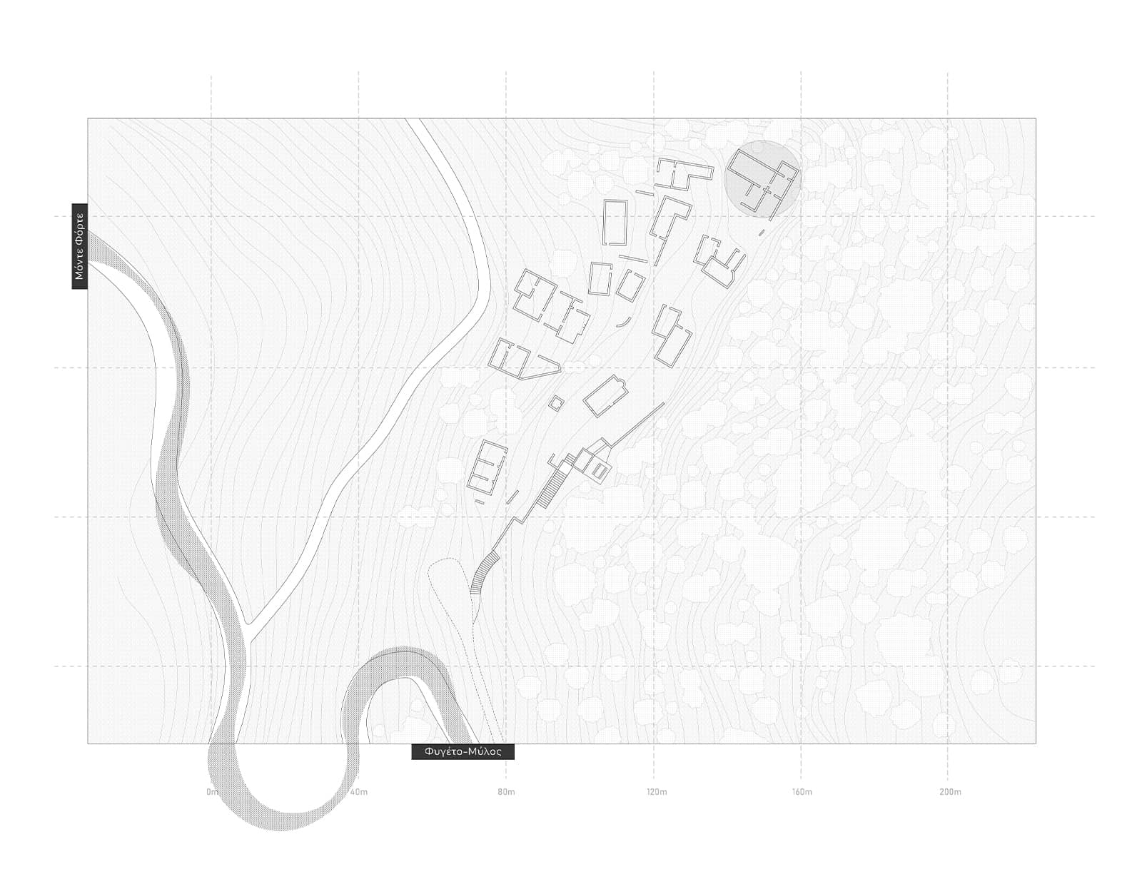
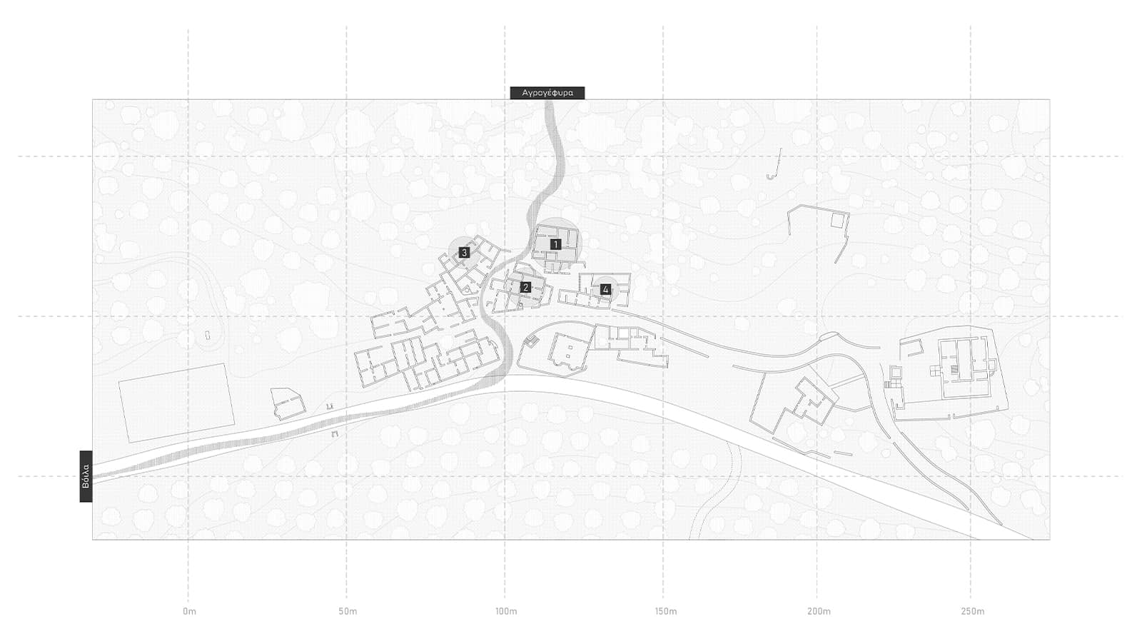
Recognizing the density of settlements in the study area, its natural and cultural wealth, as well as the existence of part of the large E4 hiking network, our central idea revolved around two axes: the creation of one or more dynamic communities and their interaction with a hiking route of natural and historical interest.
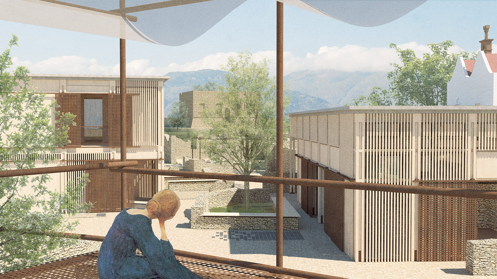
Our main concern is to strengthen the concept of community by promoting cooperation, socialization, and autonomy. Equally important is the creation of “fertile ground” for interaction between communities and both the local population (creating a relationship of mutual development) and users of the hiking trail.
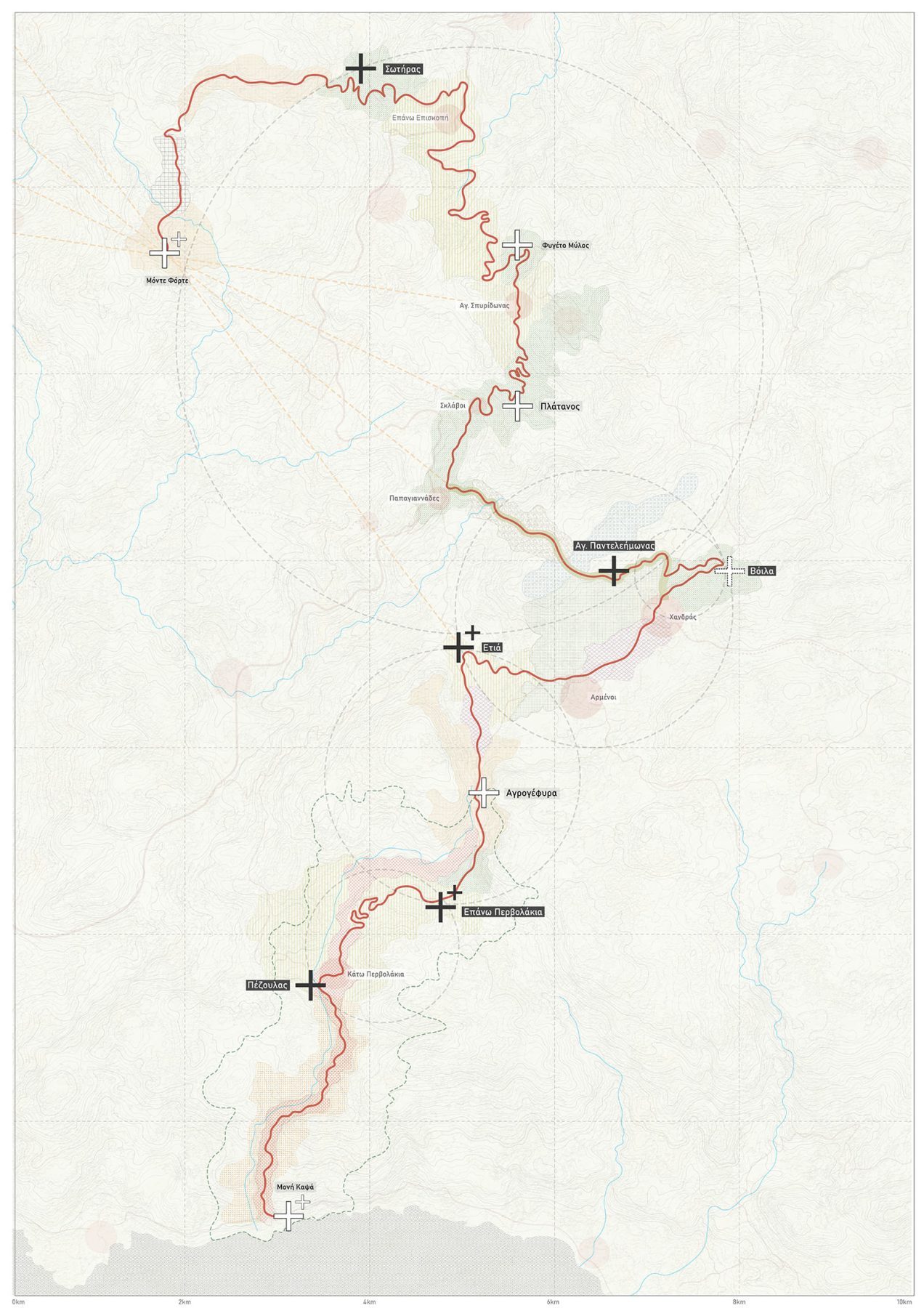
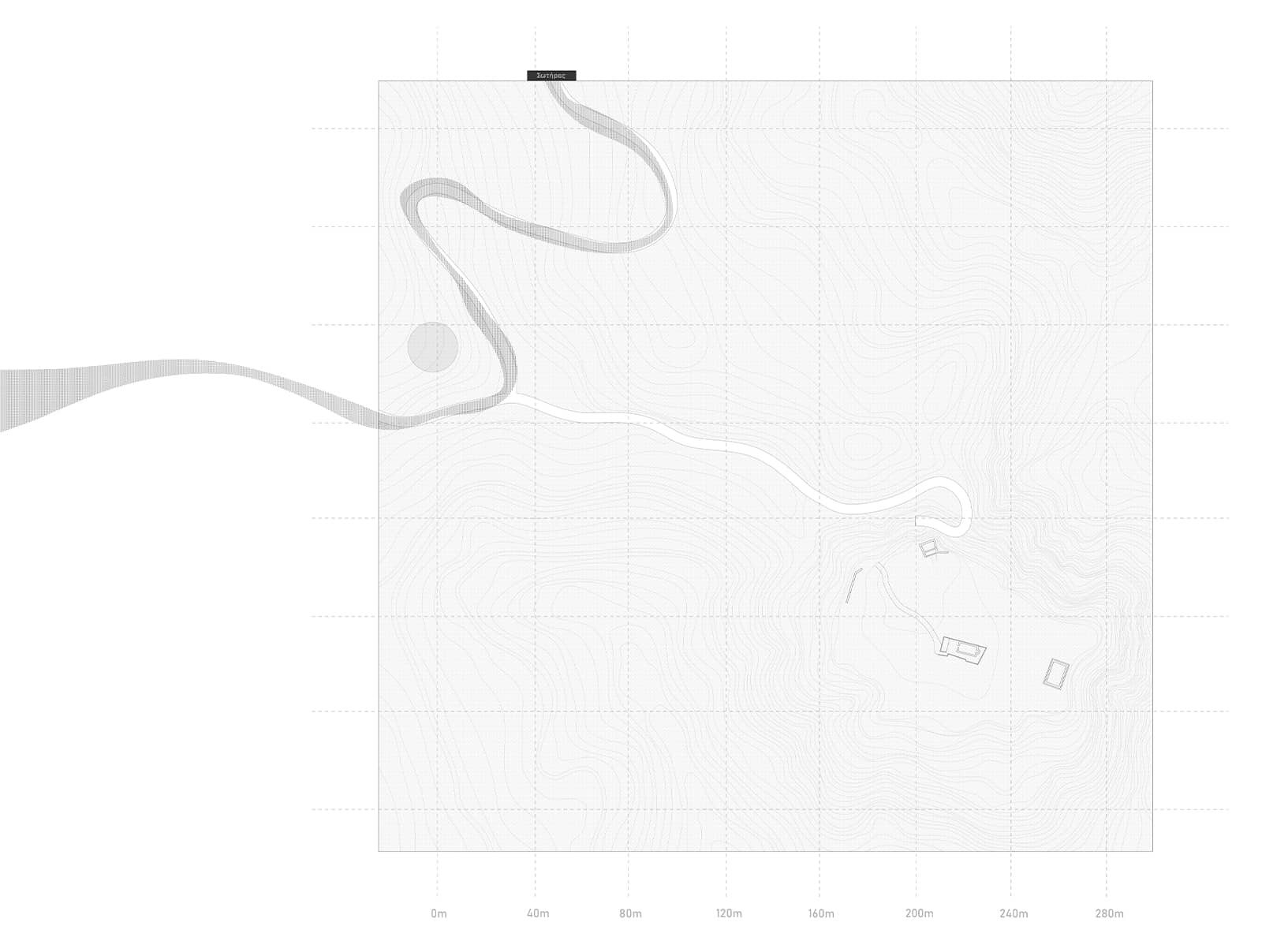
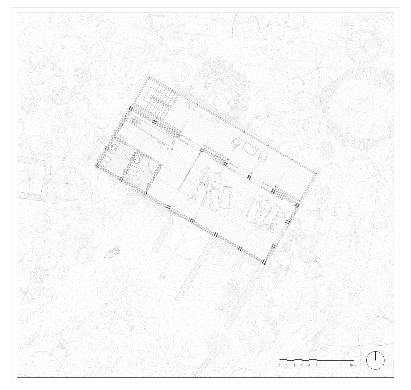
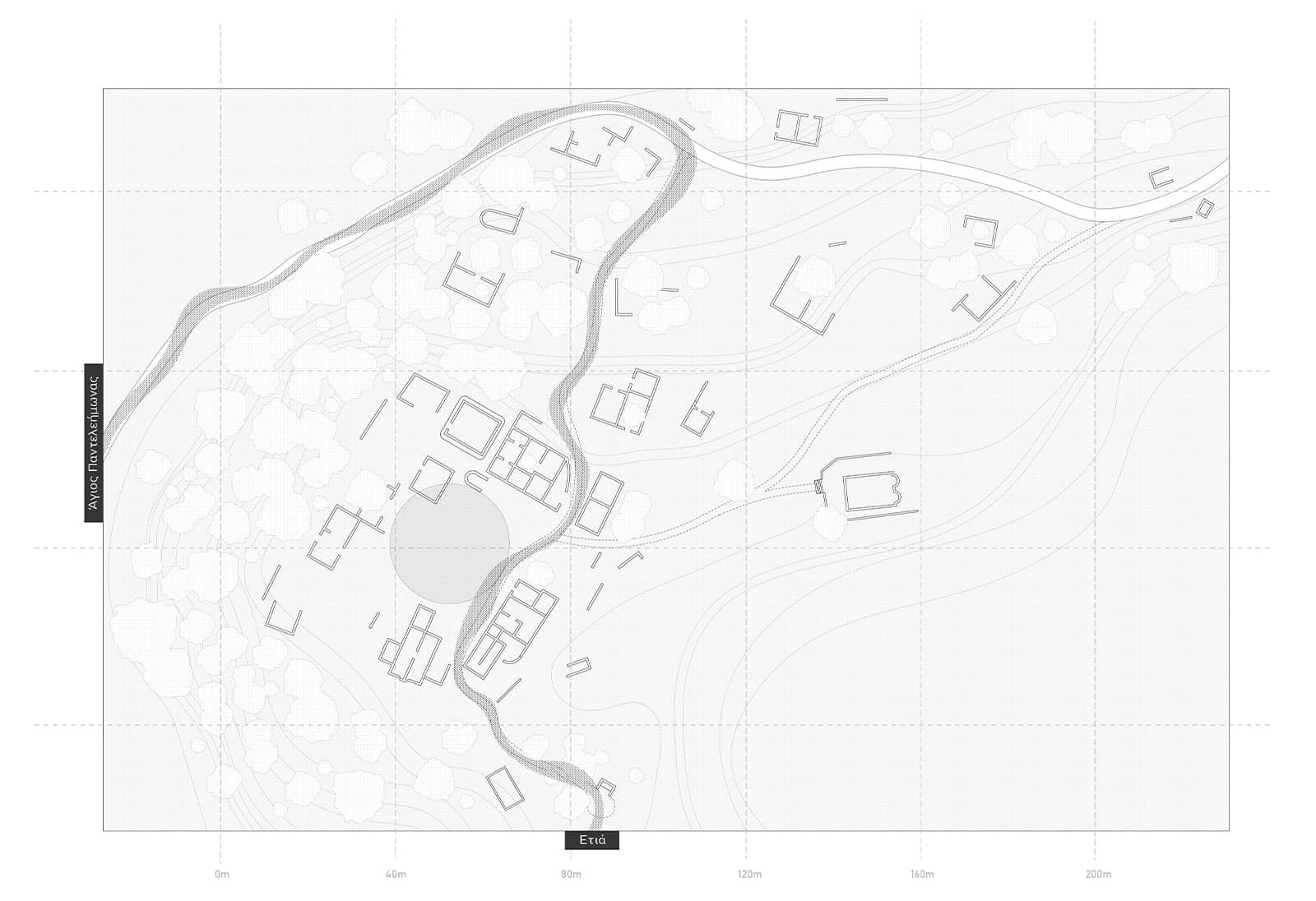
As part of the project, seven points of interest were studied in depth, and a total of eleven were selected: observation points were placed at Monte Forte, the starting point of the route, and at the Kapsas Monastery, its terminus. The abandoned settlement of Etia constituted the largest part of our work, hosting the community’s use, while the corresponding abandoned settlements of Sotiras and Voila were selected for use as a refuge and event space, respectively. Small stops were placed at points of secondary interest, such as Fygeto-Mylos, Krini Perri, and Agrogéfira.
Facts & Credits
Project title Towards a (re)appropriation: a hiking network in the abandoned villages of Eastern Lasithi
Type Design Thesis
Students Skouloudis Apostolos, Tsinikas Christos, Friligkos Iasonas
Supervisor Theodora Papidou
Presentation Date June 2025
University School of Architecture, Aristotle University of Thessaloniki
Text by the authors
SILVER TRACES: Revitalizing Lavrion’s industrial memory through a multisensory cultural path
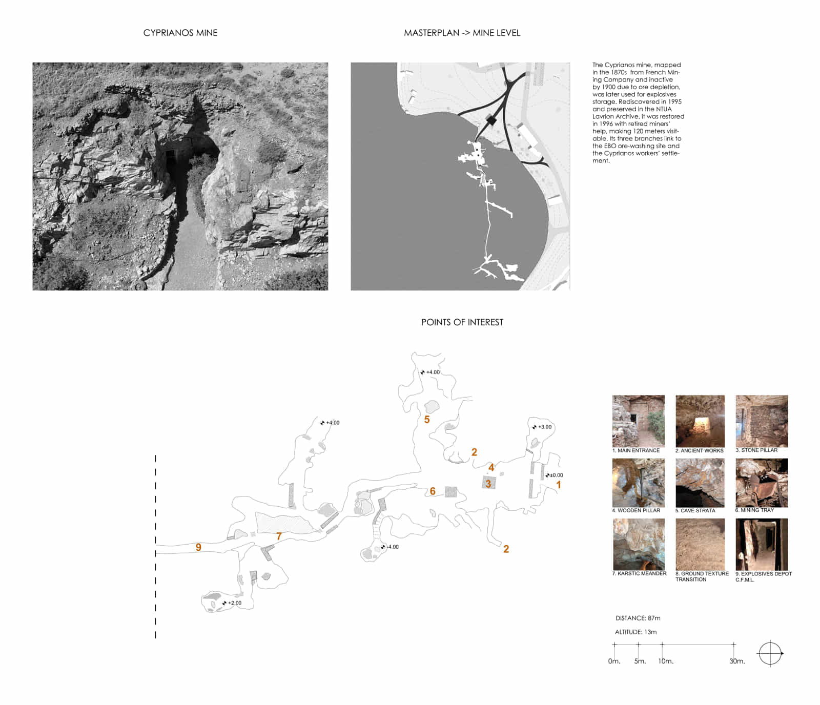
The thesis reimagines the Cyprianos mine in Lavrion as a cultural and environmental landmark through a symbolic path merging history, culture, and architecture for the city’s revitalization. Once an abandoned industrial remnant, the mine becomes a historical monument where visitors experience the role of the miner through a multisensory path.
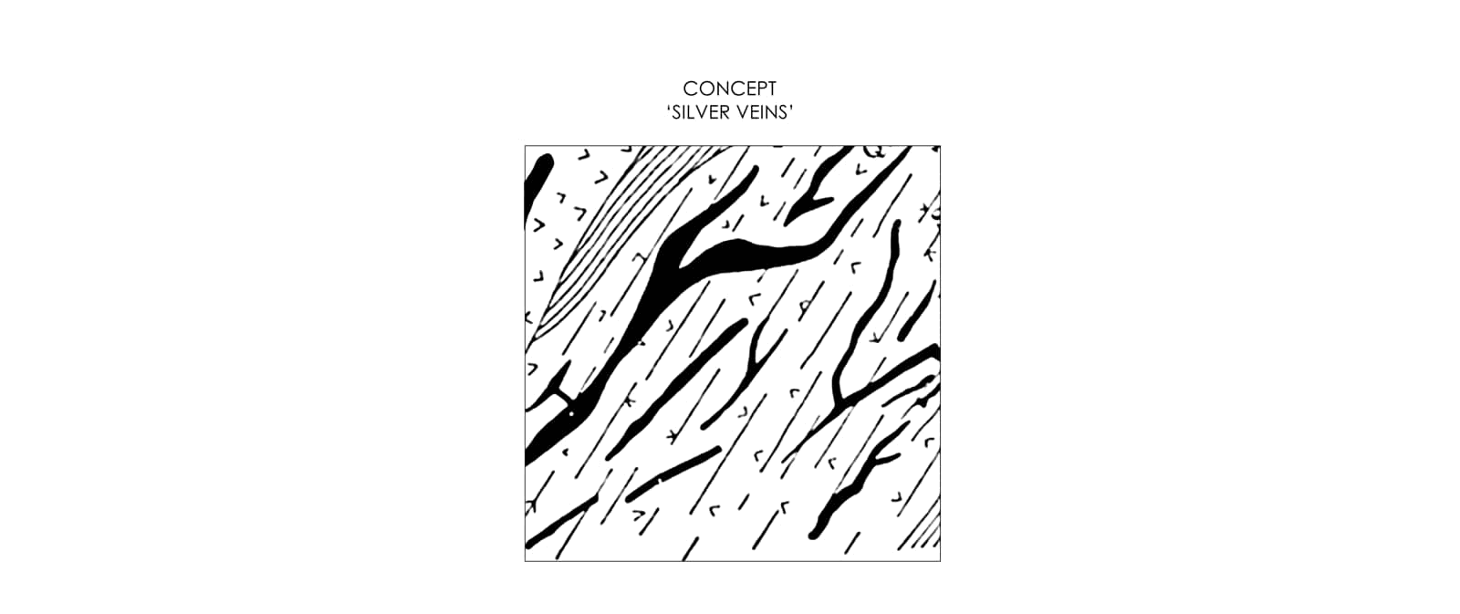
The architectural narrative is grounded in the symbolic ‘silver vein’, the geological formation that historically shaped the wealth and identity of Lavrion.
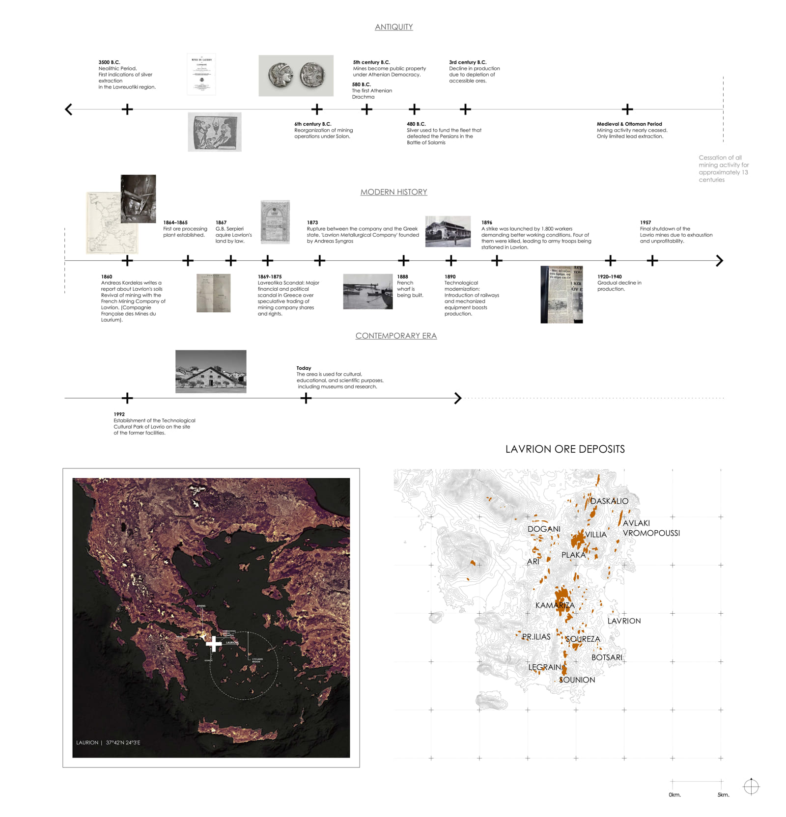
Lavrion is one of the most important mining regions of the Mediterranean, with a history dating back to the 6th century BC. Its geological abundance, unique on a global scale, defined its long-term development, as mineral wealth became a source of economic and social growth as well as a subject of scientific study. In modern times, Lavrion emerged as an industrial center of the Greek state.
Today, with traces of mining activity embedded into the landscape, the city is called upon to redefine its role as a living monument of industrial heritage.
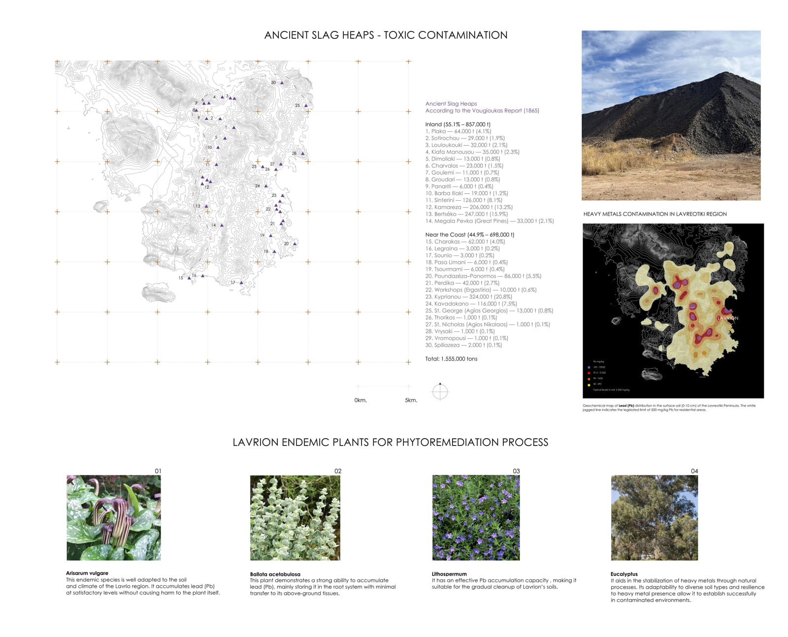
The study of the site highlighted both the vast scale of ancient and modern mining activities and the environmental burden they left behind. Within this framework, contemporary practices of ecological remediation were investigated, with emphasis on phytostabilization, a method that employs endemic plants to limit heavy metals and gradually restore the landscape.
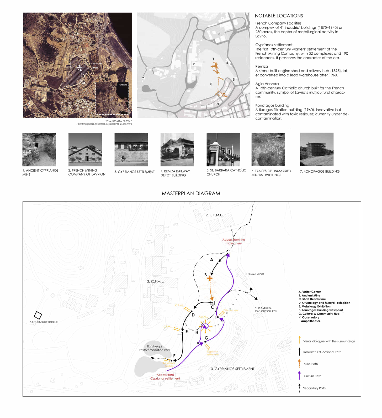
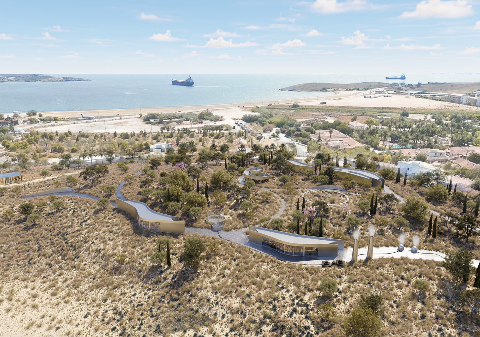
The project area is located on Cyprianos Hill, and forms an integral part of Lavrion’s historic mining landscape.
At the heart of the narrative is the Cyprianos mine, which, from an abandoned remnant bearing traces of ancient and modern extraction, is transformed into an experiential monument.
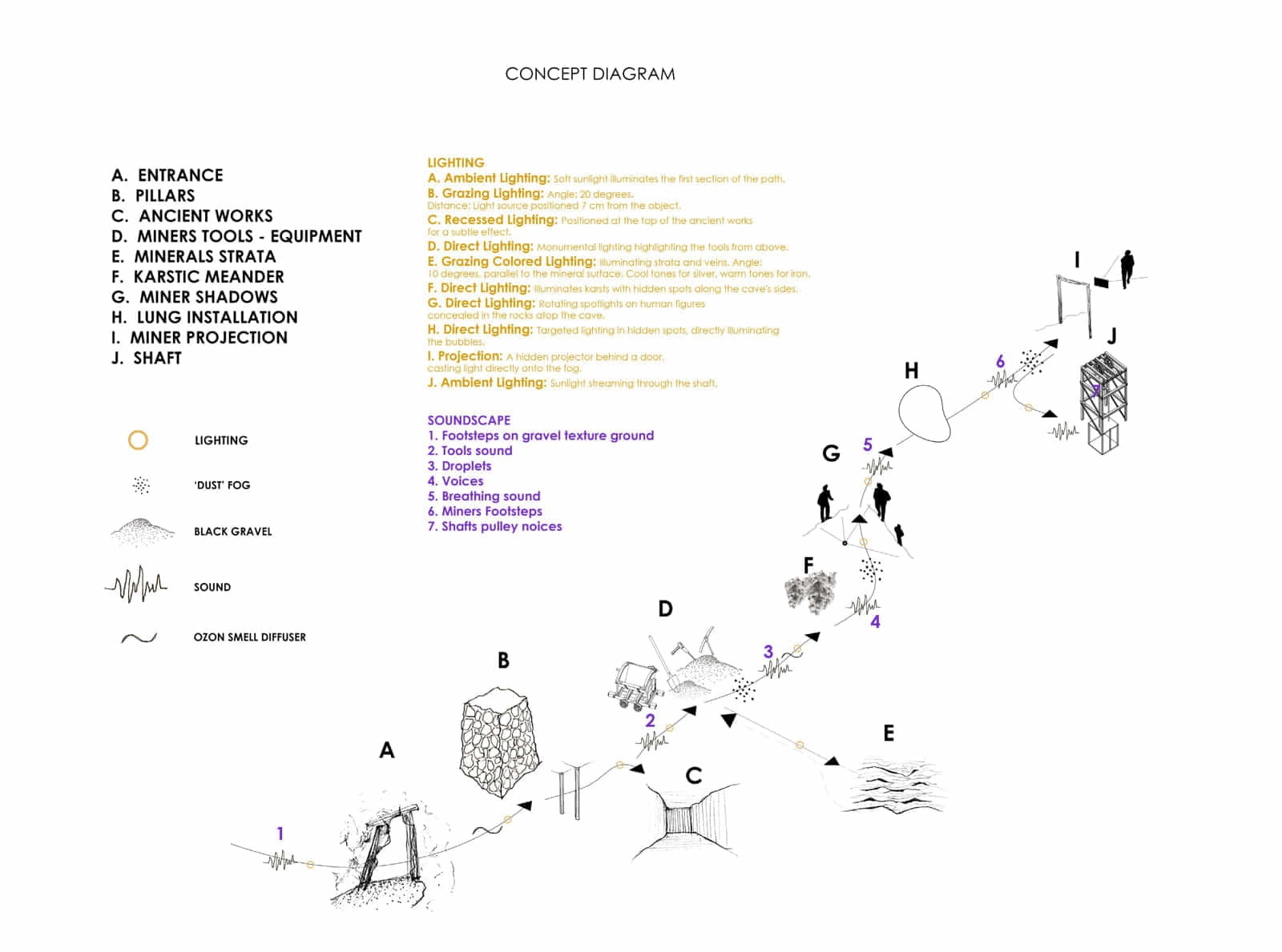
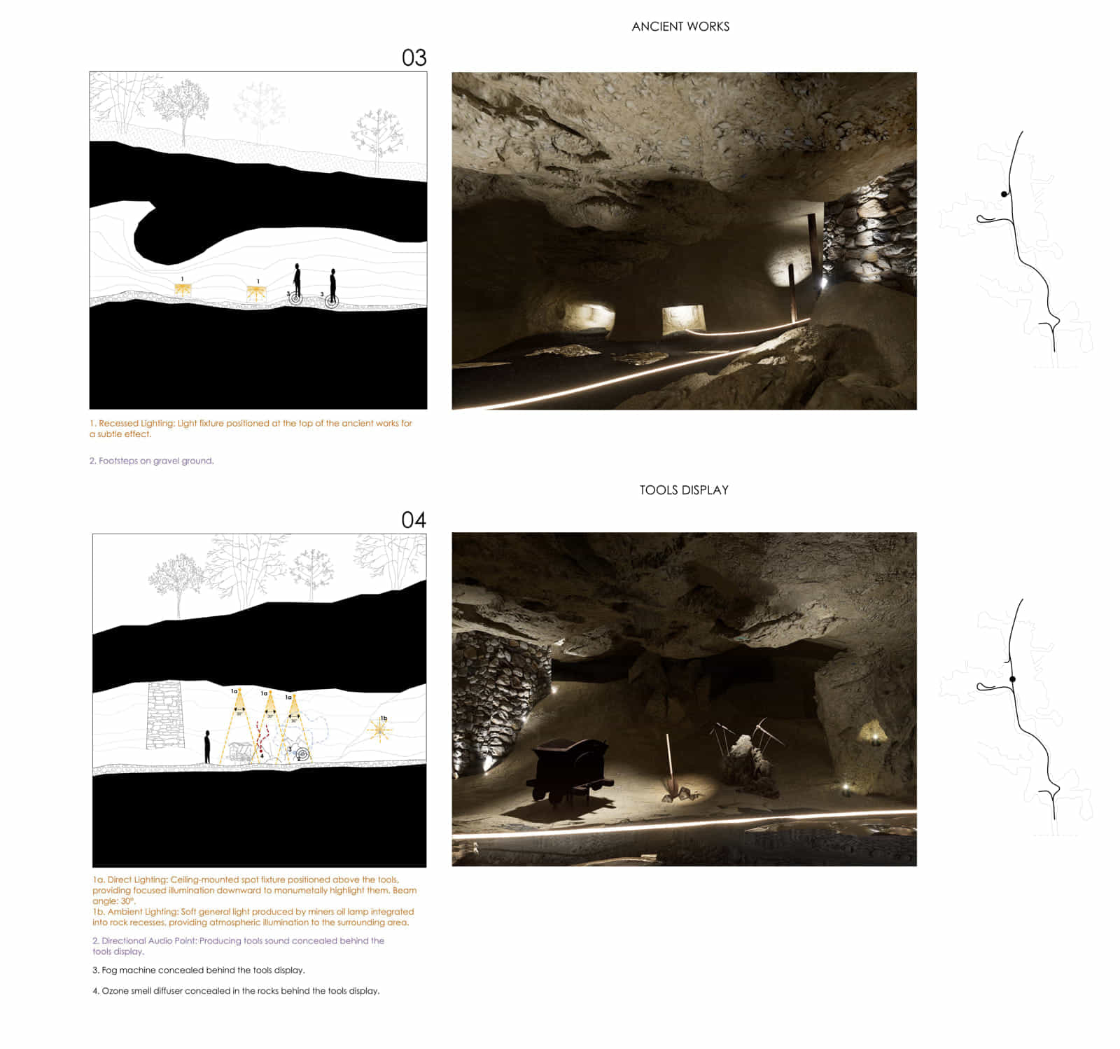
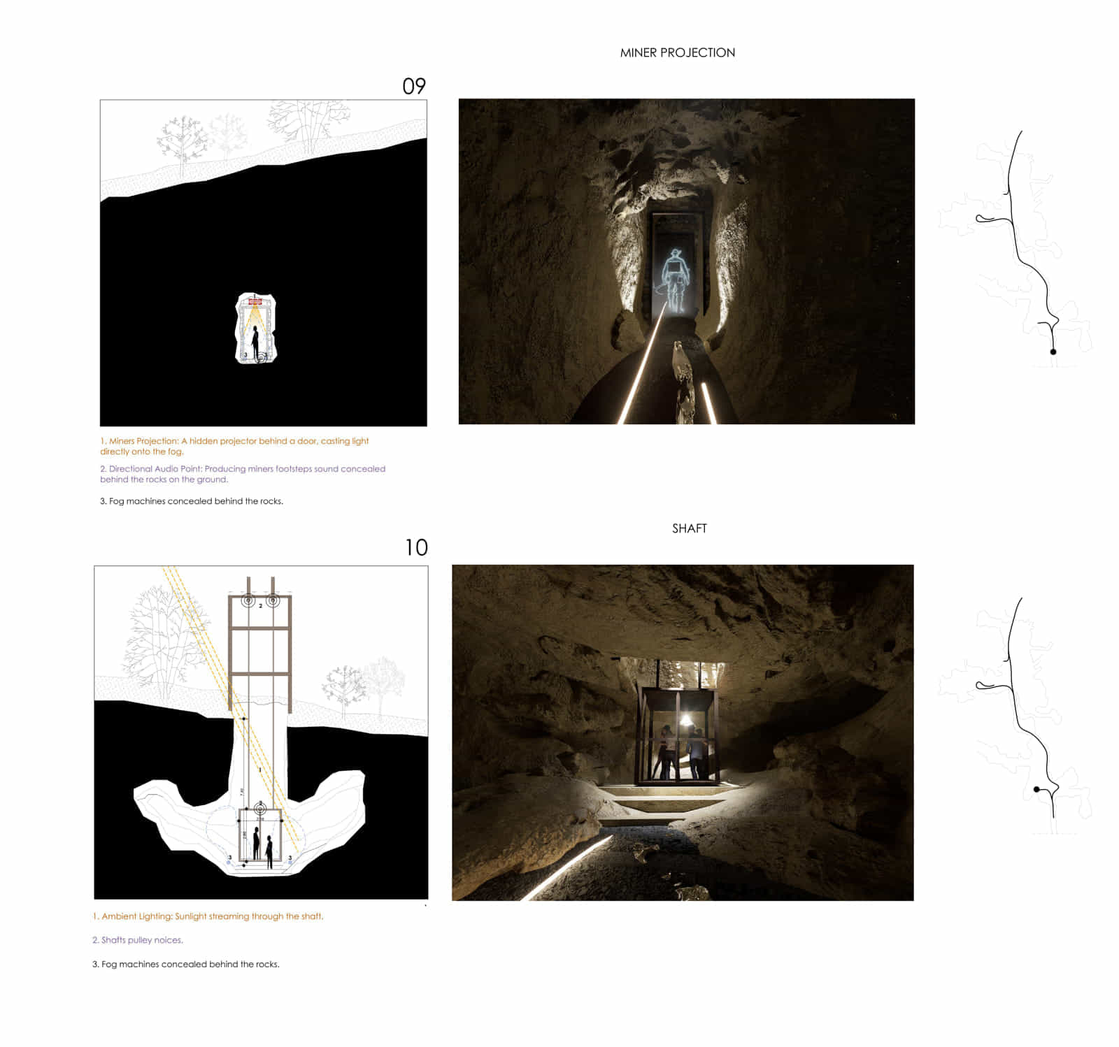
It constitutes a core of inspiration, as the design is based on the interpretative reading of the ‘silver vein’. Just as ancient miners followed the vein to locate the ore, so too the visitor follows an architectural narrative linking the underground journey with a sequence of above – ground stations dedicated to culture, research, and ecological restoration, enhancing and enriching the overall experience.
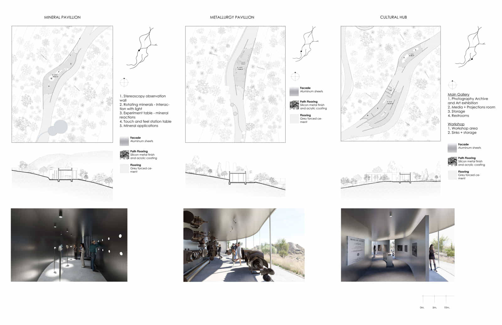
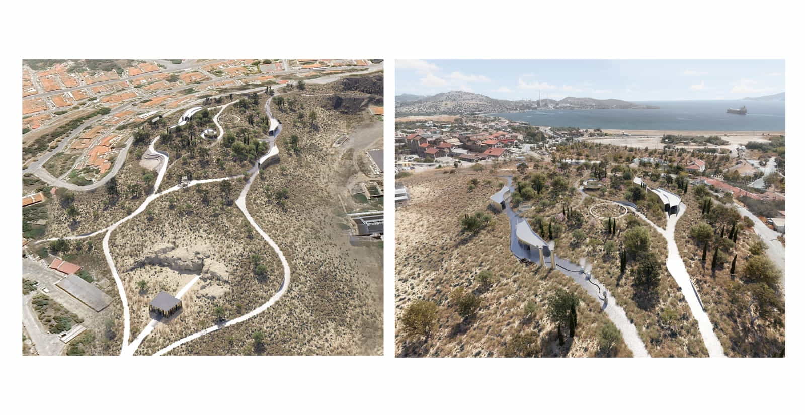
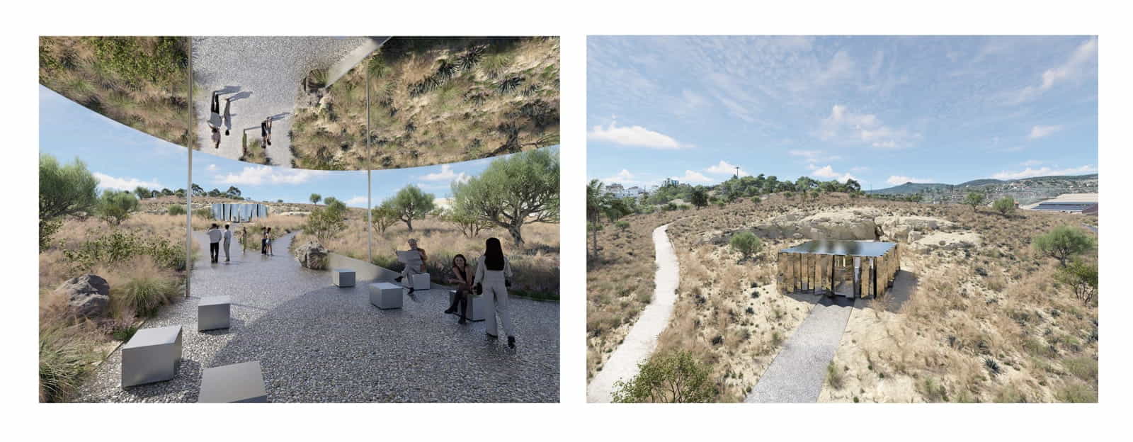
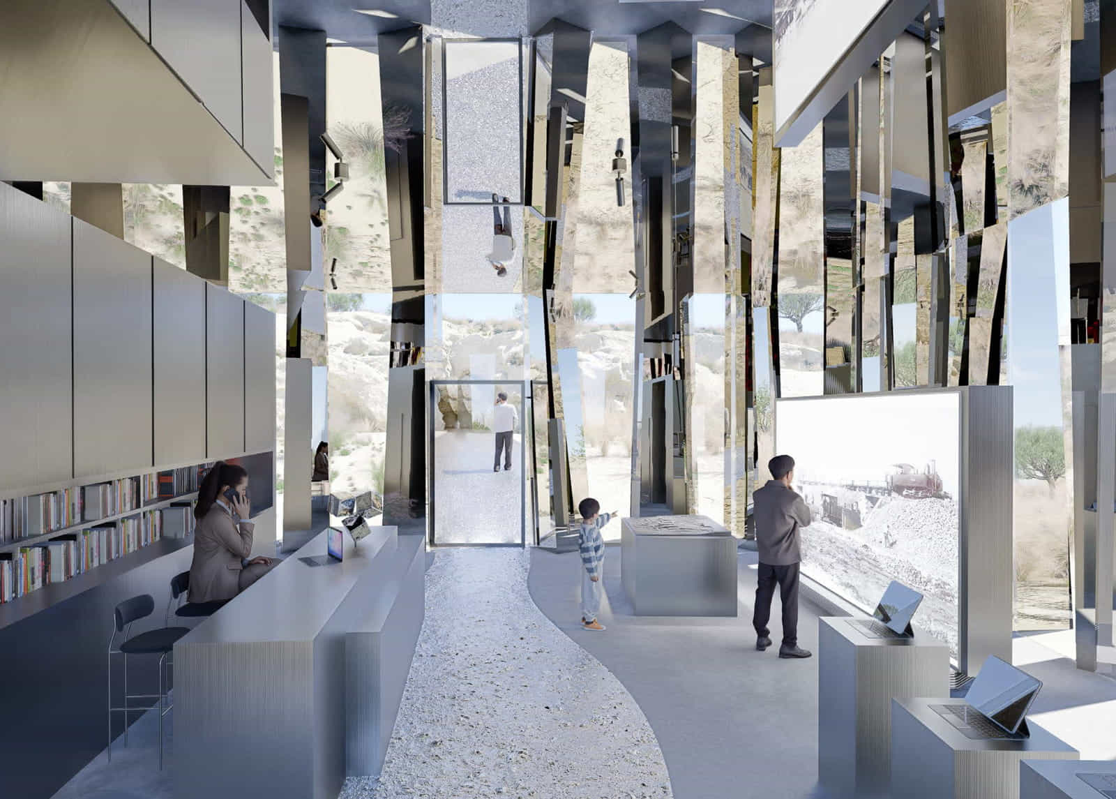
Each stop acts as a distinct spatial chapter. The path begins at the Visitor Center, inspired by the mineral of galena, the first mineral recognized by ancient miners, clad in reflective surfaces that act as a threshold and landmark of discovery. It continues with the Mineral Pavilion, showcasing Lavrion’s geological wealth, and the Metallurgy Pavilion, where authentic tools and machinery are exhibited in dialogue with the buildings of the French Mining Company. The path culminates at the Konofagos Observatory, framed by slag heaps undergoing phytostabilization, offering an experience of ecological reflection.
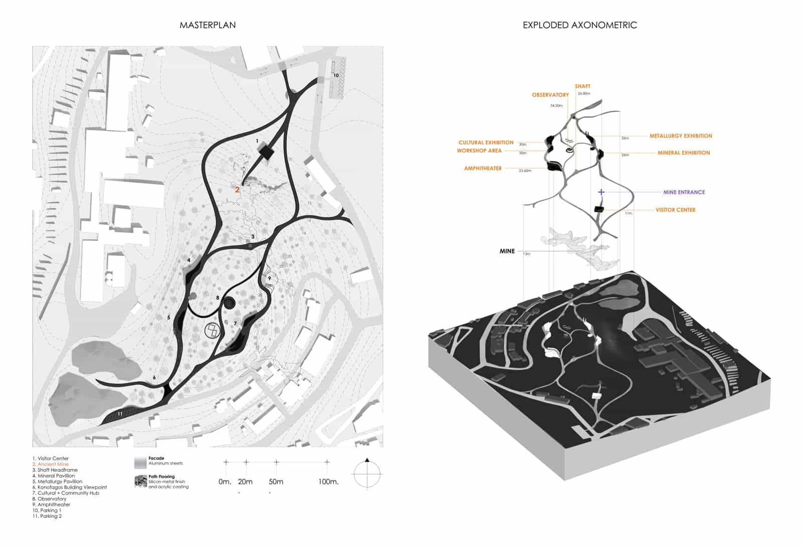
In parallel, the cultural route leads to the Cultural Center, connected to the settlement of Cyprianos, where industrial heritage meets contemporary creativity through exhibitions and participatory programs. At the top of the hill, the 360° observatory and the amphitheater, engraved in the natural slope of the terrain, complete the experience by highlighting the interrelation of landscape, history, and collective memory.
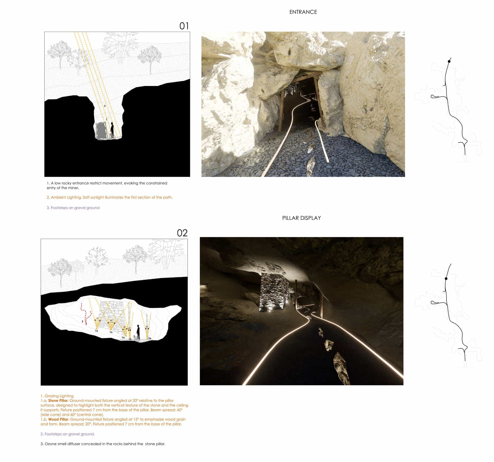
The design of the gallery follows a phenomenological approach, where architecture does not merely represent history but seeks to integrate the visitor’s embodied experience.
Through light, sound, scents, atmosphere, and artistic installations, the gallery becomes a living monument that awakens the senses and conveys the physical and emotional struggle of underground labor.
The visitor experiences a first – person journey, discovering through their own body the miner’s reality beneath the earth.
This proposal goes beyond museological representation, positioning Lavrion at the center of a broader dialogue on industrial heritage in Greece. History, ecology, and architecture are interwoven, redefining Lavrion as a living monument of collective memory, culture, and creation.
Facts & Credits
Project title SILVER TRACES: Revitalizing Lavrion’s industrial memory through a multisensory cultural path
Type Design Thesis
Student Metaxia Ioanna Gougougian
Supervisor Aikaterini Liapi
Presentation Date September 2025
University School of Architecture, University of Patras
Text by the author
Traversing the Landscape – The Building as a Journey
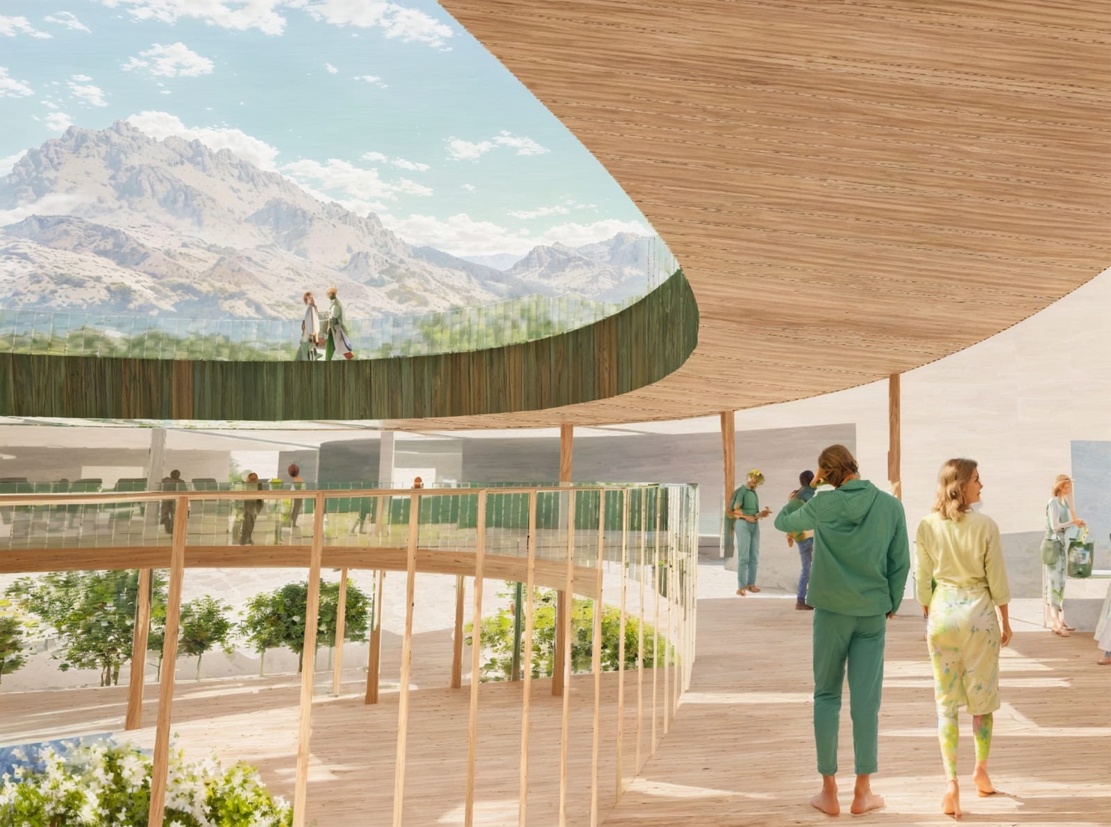
This thesis, Traversing the Landscape – The Building as a Journey, explores the design of a new School of Arts in Kalambaka, inspired by the city’s historic Woodcarving School.
The project aims to celebrate cultural heritage while promoting artistic creation through a space that harmoniously blends tradition and contemporary architecture.
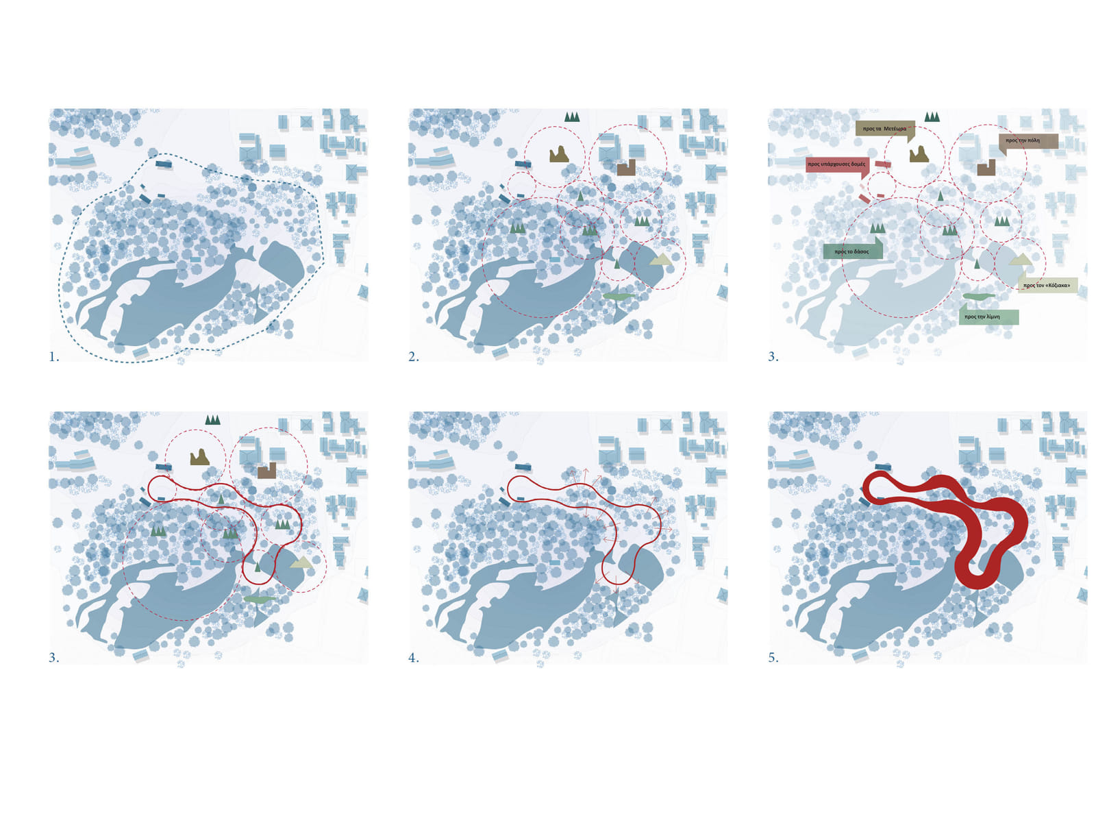
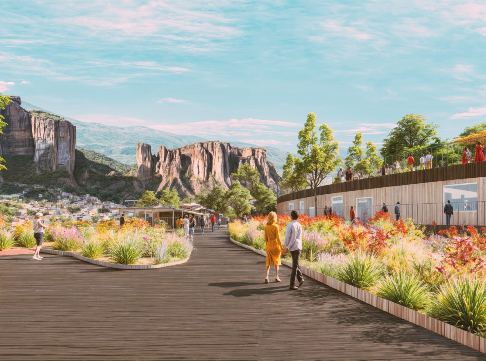
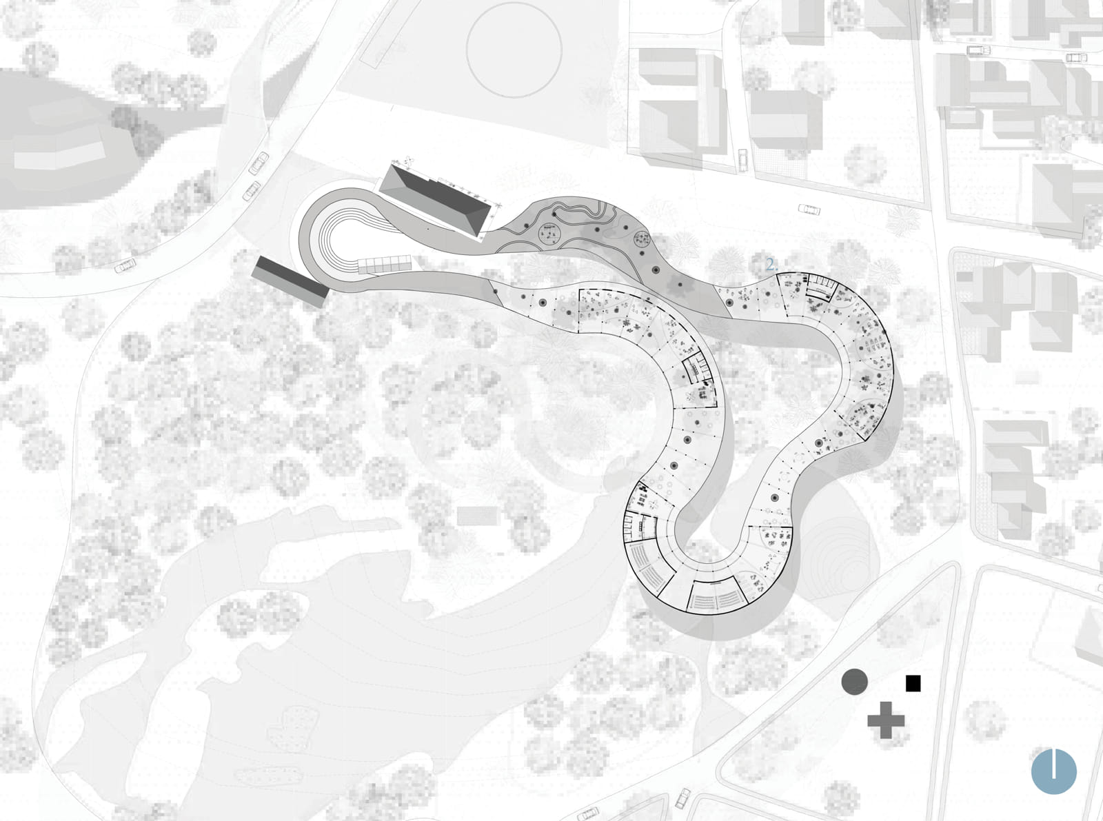
Kalambaka, situated at the foothills of Meteora, has a deep connection to art and spirituality. The existing Woodcarving School, unique in Greece, served as a key reference for designing a new institution that integrates three artistic disciplines: woodcarving, painting, and sculpture. The selection of Prophet Elias Hill as the site was intentional; its natural landscape, historical significance, and nearby landmarks provide a compelling setting for a building with educational and cultural functions
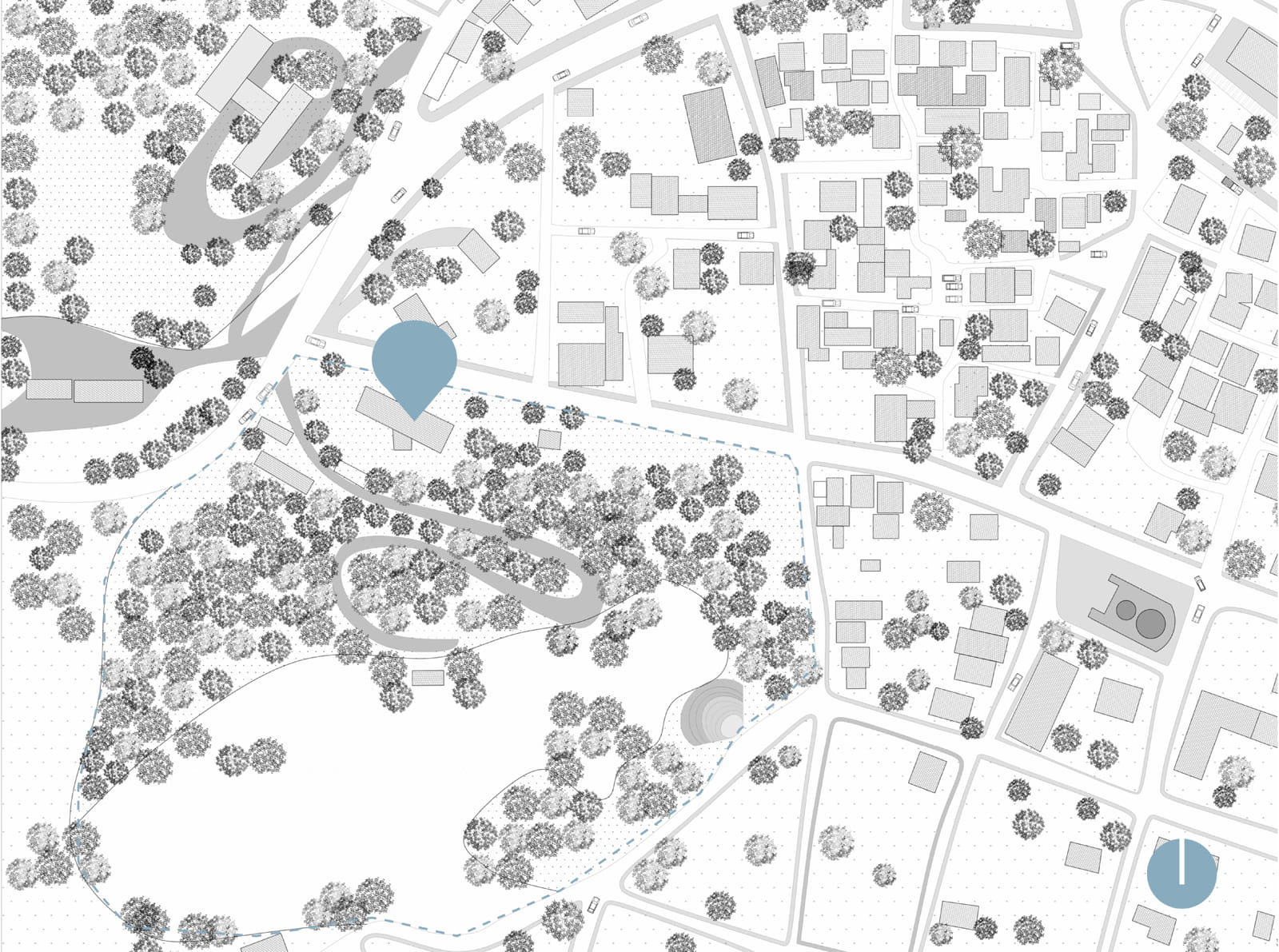
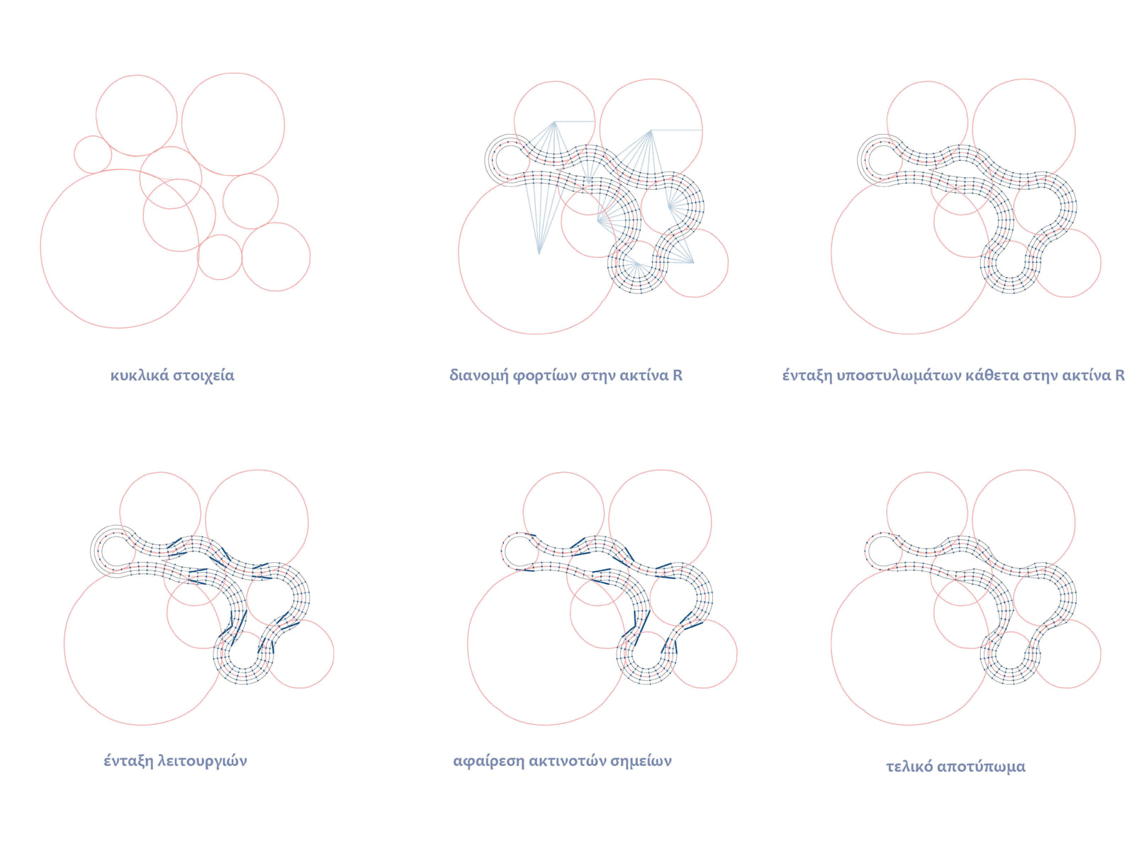
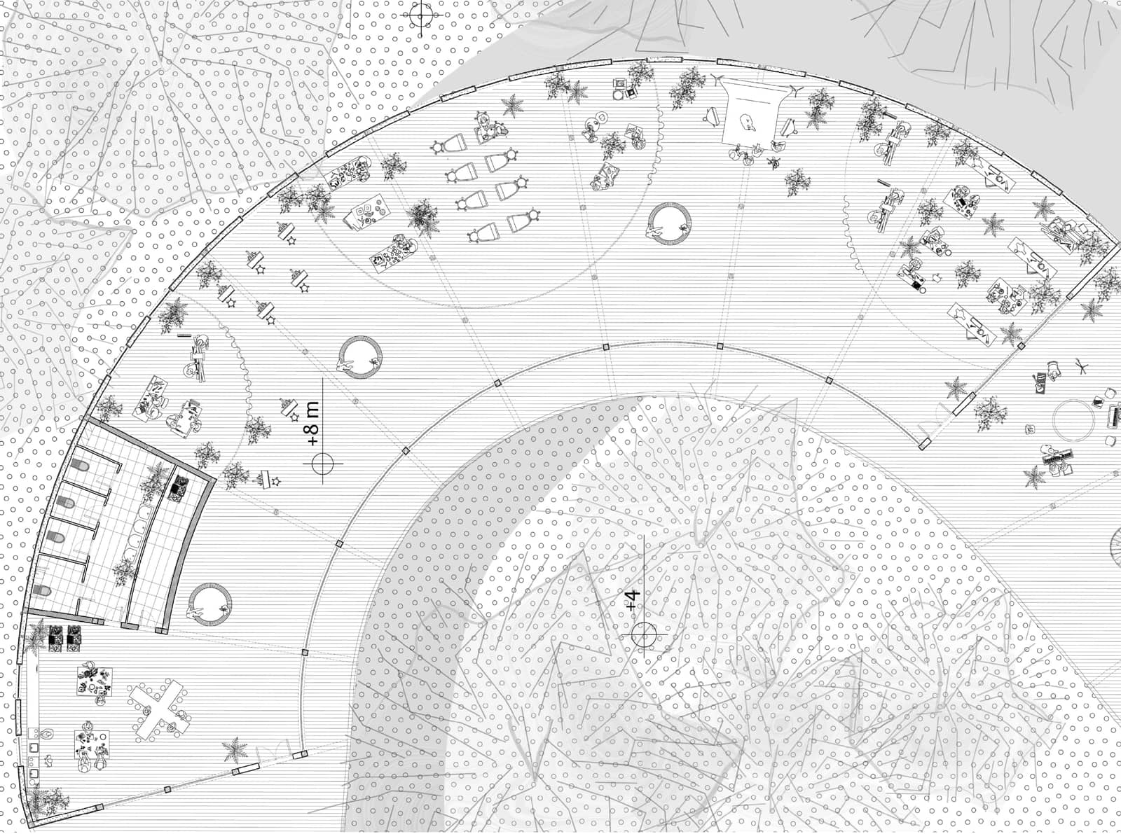
The central design concept is built around the notion of a journey, where the natural curves of the landscape and the contours of the Meteora rocks are translated into a continuous architectural pathway that organizes the building’s spaces
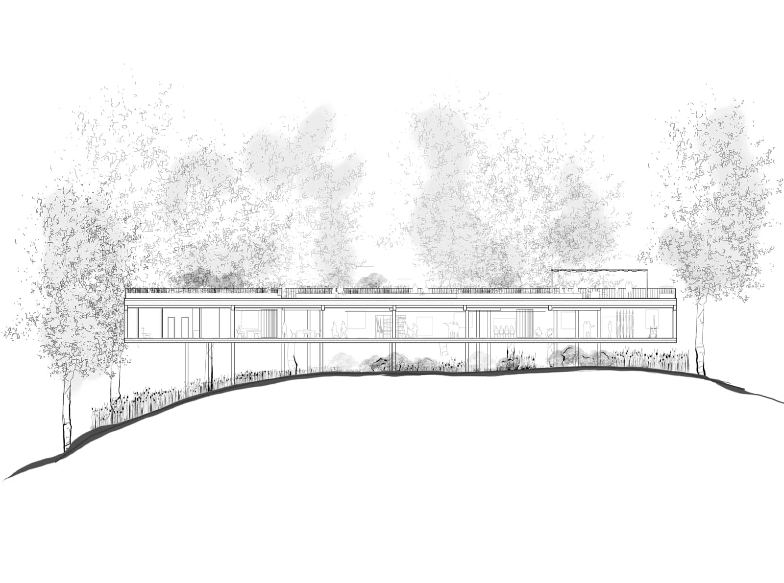
The structure employs a metal framework that follows the site’s circular topography, ensuring adaptability while minimizing environmental impact.
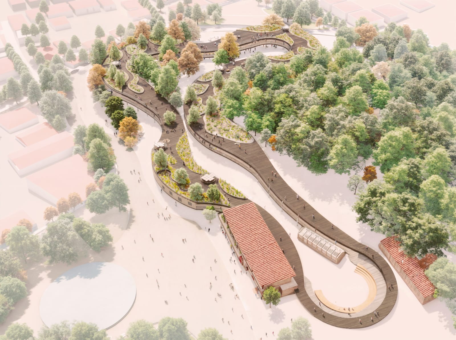
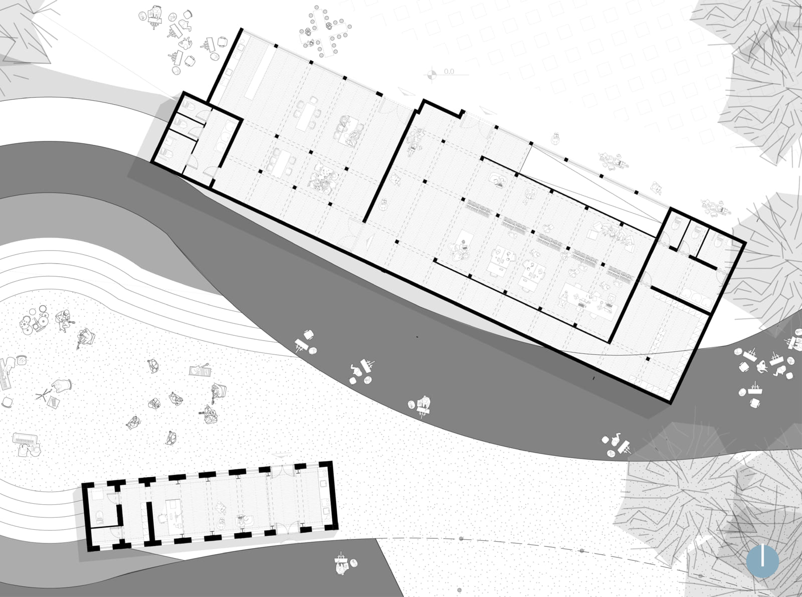
The building program includes classrooms, workshops, a library, exhibition areas, and auditoriums, complemented by spaces for social interaction and relaxation (Figure 5. 3D view of floor plan, Figure 6. Proposed floor plan).
The functions are distributed across four primary enclosed volumes, with semi-outdoor intermediate spaces maintaining a direct connection to the surrounding landscape. The roof is designed as a green terrace , providing ecological and social benefits.
The design approach emphasizes sustainability and respect for the landscape.
Section A–A illustrates the building’s relationship to the slope, while the construction detail of the metal frame with wooden cladding demonstrates the technical integration of materials.
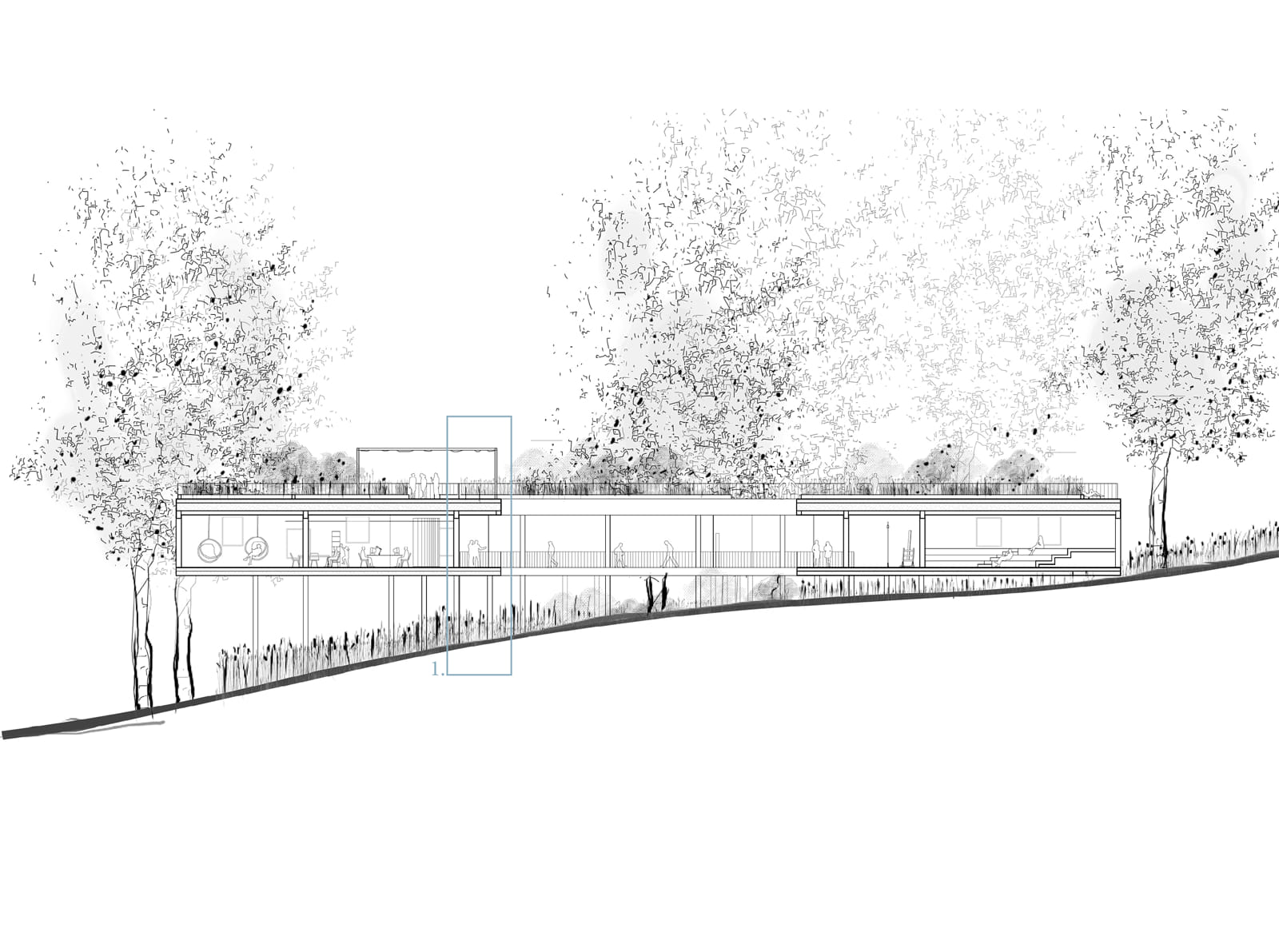
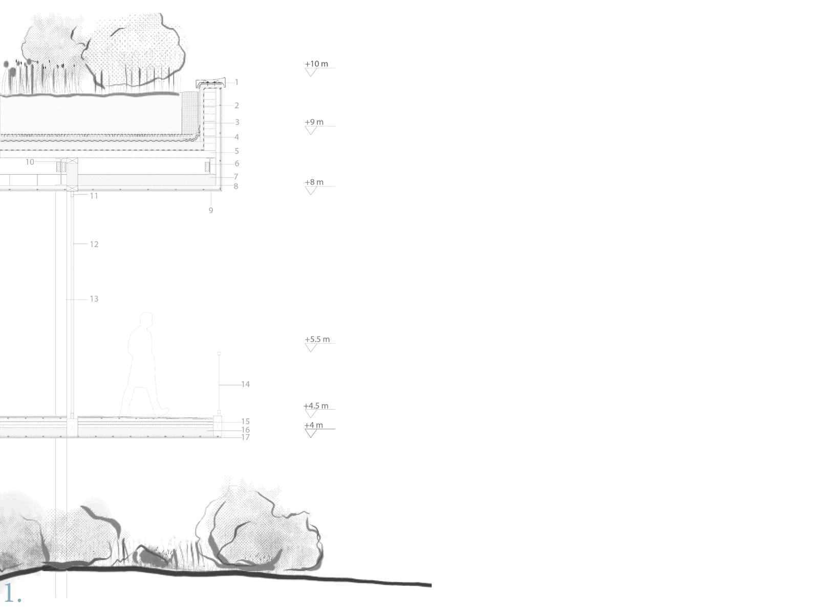
Adaptive reuse of existing structures, such as the old Woodcarving School, is a key focus, and the integration of old and new buildings is highlighted in the 3D view .
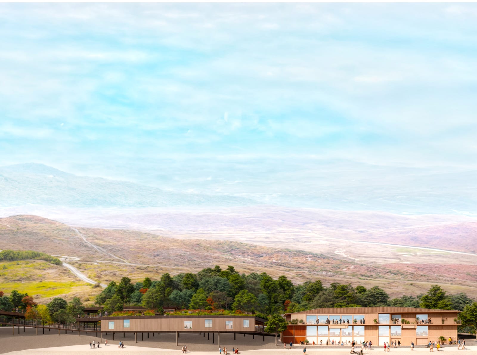
Beyond the building itself, the proposal aims to regenerate the surrounding area of Prophet Elias Hill by enhancing green spaces, creating a cultural park, and improving accessibility, serving as a catalyst for the cultural and environmental revitalization of the city.
Overall, the project seeks to merge tradition with contemporary architectural expression, creating a space for learning, artistic practice, and inspiration that respects the landscape while reinforcing art as a defining element of Kalambaka’s identity.
Facts & Credits
Project title Traversing the Landscape – The Building as a Journey
Type Design Thesis
Student Maria Karali
Supervisor Dimitris Thomopoulos
Presentation Date 2024
University School of Architecture, Aristotle University of Thessaloniki
Text by the author